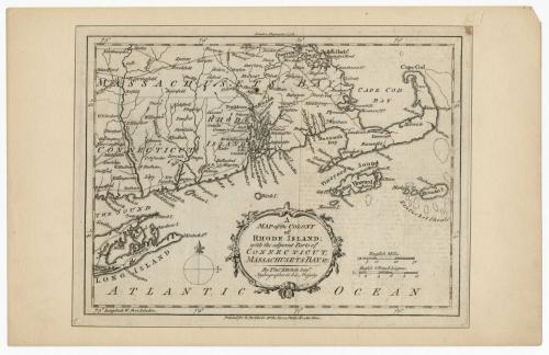
A Map of the Colony of Rhode Island: with adjacent parts of Connecticut, Massachusets Bay, &c.
PrintmakerEngraved by
Thomas Kitchin
(British, 1719 - 1784)
PublisherPublished by
R. Baldwin
(British, active 1749 - 1810)
Date1778
MediumEngraving; black printer's ink on laid paper, inlaid in wove paper
DimensionsPrimary Dimensions (image height x width): 7 x 9 1/2in. (17.8 x 24.1cm)
Sheet (height x width): 7 1/2 x 9 7/8in. (19.1 x 25.1cm)
Mount (height x width): 8 5/8 x 13 1/2in. (21.9 x 34.3cm)
Sheet (height x width): 7 1/2 x 9 7/8in. (19.1 x 25.1cm)
Mount (height x width): 8 5/8 x 13 1/2in. (21.9 x 34.3cm)
ClassificationsGraphics
Credit LineGift of William C. Conklin
DescriptionMap of Rhode Island, with Massachusetts Bay (Massachusetts) to the north and east, part of Long Island and the Long Island Sound to the south, and part of Connecticut to the west. Population centers are marked with open circles, and what appear to be roads are shown as double parallel lines. Rivers and islands are depicted and labeled, and waterfalls are marked.
Object number1971.71.5
NotesCartographic Note: Scale: About 1/4 inch equals 5 milesOn View
Not on view

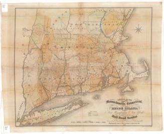

Lucius Stebbins & Co.
1859