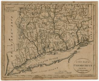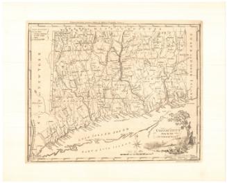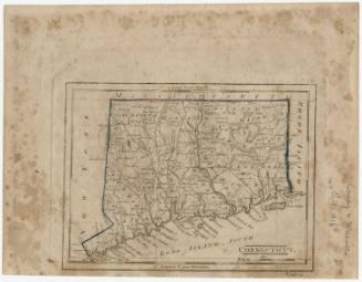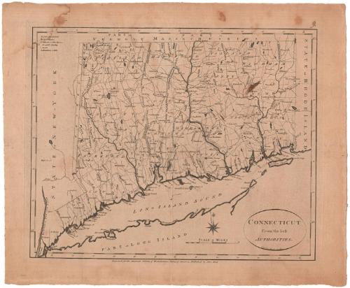
Connecticut From the best Authorities
DraftsmanDrawn by
Benjamin Tanner
(American, 1775 - 1848)
PrintmakerEngraved by
Benjamin Tanner
(American, 1775 - 1848)
PublisherPublished by
John Reid
(American, probably 1764 - 1828)
Date1796
MediumEngraving; printed in black ink on laid paper
DimensionsPrimary Dimensions (image height x width): 13 7/8 x 17 1/8in. (35.2 x 43.5cm)
Platemark (height x width): 4 3/4 x 18in. (12.1 x 45.7cm)
Sheet (height x width): 17 x 20 1/2in. (43.2 x 52.1cm)
Platemark (height x width): 4 3/4 x 18in. (12.1 x 45.7cm)
Sheet (height x width): 17 x 20 1/2in. (43.2 x 52.1cm)
ClassificationsGraphics
Credit LineGift of William C. Conklin
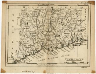
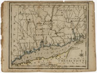
DescriptionThe state of Connecticut, with the borders of Vermont and Massachusetts to the north, Rhode Island to the east, Long Island and the Long Island Sound to the south, and the oblong and New York to the west. The state is divided into counties and towns, with sketches of little buildings indicating courthouses, and open circles indicating churches or other houses of public worship. Elevation is depicted using clusters of peaks. The Stratford (Housatonic), Naugatuc (Naugatuck), Connecticut, Farmington, Windsor, Thames, Quinabaug, and Shetucket Rivers are among the rivers shown. Other natural features include ponds.
Object number1971.71.2
NotesCartographic Note: Scale: 3/4 inches equals 5 milesOn View
Not on view