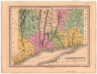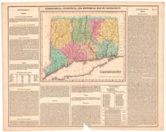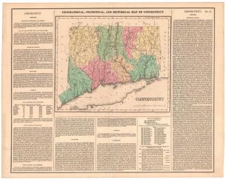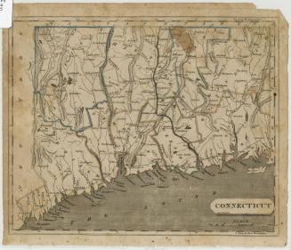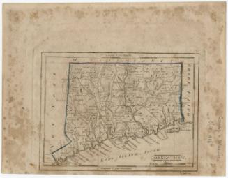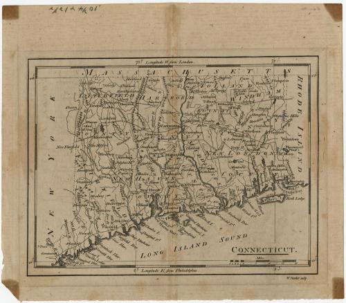
Connecticut
PublisherPublished by
Mathew Carey
(American, 1760 - 1839)
PrintmakerEngraved by
William Barker
(American, active 1792 - 1805)
Date1801
MediumEngraving; black printer's ink on paper
DimensionsPrimary Dimensions (image height x width): 5 5/8 x 7 1/2in. (14.3 x 19.1cm)
Platemark (height x width): 6 x 8in. (15.2 x 20.3cm)
Sheet (height x width): 7 5/8 x 8 7/8in. (19.4 x 22.5cm)
ClassificationsGraphics
Credit LineHoadley Fund
Object number1946.16.5
DescriptionMap of the state of Connecticut, with Massachusetts to the north, Rhode Island to the east, the Long Island Sound to the south, and New York State to the west. The state is divided into counties that are labeled and delineated with dotted lines. Elevation is conveyed with clusters of peaks, and other natural features include rivers, ponds, islands, harbors, reefs and points.
Label TextIn 1801, Mathew Carey issued a second edition of his American Pocket Atlas, first published in Philadlephia in 1796. The map of Connecticut was virtually identical with the version that appeared in the first edition, despite the incorporation of several new towns in the interim. The only significant addition is the post roads, probably based on assistant postmaster general Abraham Bradley's 1796 Map of the United States exhibiting the Post Roads.
NotesCartographic Note: Scale: 2 inches equals 10 milesStatus
Not on view