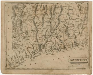
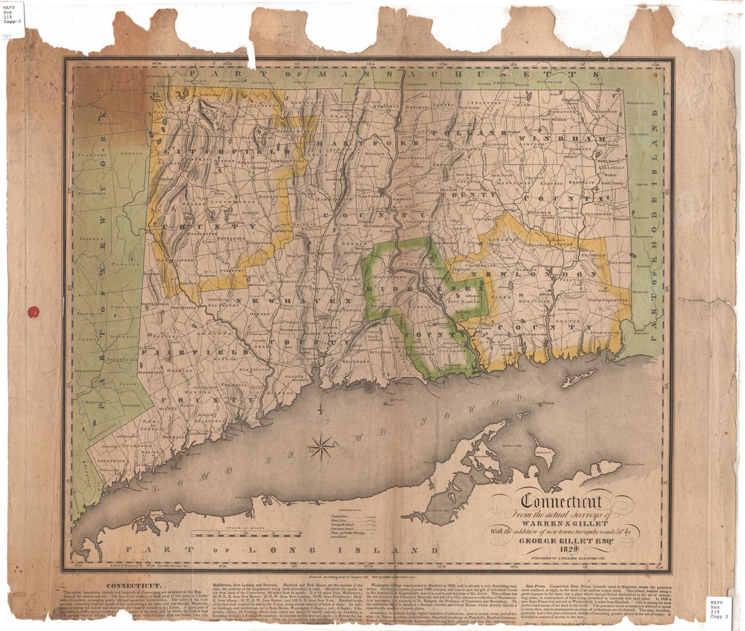
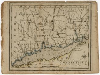
Connecticut
DraftsmanDrawn by
Samuel Lewis
(American, 1754 - 1822)
Date1812
MediumEngraving; black printer's ink on wove paper
DimensionsPrimary Dimensions (image height x width): 7 7/8 x 9 3/4in. (20 x 24.8cm)
Platemark (height x width): 8 3/8 x 10 3/8in. (21.3 x 26.4cm)
Sheet (height x width): 8 3/4 x 10 3/4in. (22.2 x 27.3cm)
ClassificationsGraphics
Credit LineHoadley Fund
Object number1946.16.2
DescriptionMap of the state of Connecticut, with Massachusetts to the north, Rhode Island to the east, the Long Island Sound to the south, and New York State to the west. The state is divided into counties, labeled and delineated with dotted lines. Population centers appear to be denoted with open circles. Elevation is depicted with hachure marks. Local roads are shown. Many small rivers are shown in addition to the Connecticut, Stratford (Housatonic), Thames and Quinebaug Rivers. Harbors, points, islands, shoals and ponds are also depicted.
Label TextThe first edition of this map was included in A New and Elegant General Atlas, published by John Conrad & Company in Philadelphia in 1804. Even that early edition did not include all the towns that existed in 1804, and no new towns were added when the map was reprinted for an 1812 edition of the Atlas, even though six additional new towns had been incorporated by that date. The changing poltical makeup of the state of Connecticut during the nineteenth century posed a constant challenge to mapmakers, and not all mapmakers bothered to get it right. Maps printed and published in Connecticut are usually--but not always--more accurate than those printed and published elsewhere.
NotesCartographic Note: Scale: 1 inch equals 10 milesStatus
Not on view