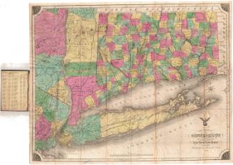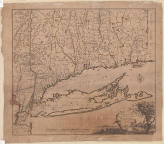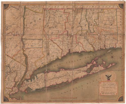
Map of the Southern Part of the State of New York including Long Island, the Sound, the State of Connecticut, part of the State of New Jersey and Islands adjacent
DesignerDesigned by
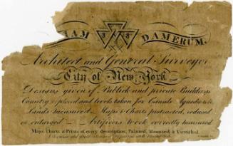
William Damerum
(American)
DraftsmanDrawn by
William Damerum
(American)
PublisherPublished by
William Damerum
(American)
PrintmakerEngraved by
Peter Maverick
(1780 - 1831)
Date1815
MediumEngraving; black printer's ink and watercolor on paper, lined with linen
DimensionsPrimary Dimensions (image height x width): 23 1/4 x 28 1/8in. (59.1 x 71.4cm)
Sheet (height x width): 24 1/4 x 29in. (61.6 x 73.7cm)
Mount (height x width): 24 1/4 x 29in. (61.6 x 73.7cm)
Sheet (height x width): 24 1/4 x 29in. (61.6 x 73.7cm)
Mount (height x width): 24 1/4 x 29in. (61.6 x 73.7cm)
ClassificationsGraphics
Credit LineMuseum purchase
DescriptionMap of parts of New York State and New Jersey, as well as all of Connecticut, from the border with Massachusetts to the north, the border with Rhode Island to the east, Long Island to the south, and parts of New Jersey and New York to the west. The states are divided into counties, which are outlined with color. Counties, towns and cities are labeled, as are geographic features such as rivers, mountains and islands. Elevation is conveyed with clusters of peaks. Roads are depicted but not labeled. Directly above the cartouche is a globe with an eagle perched on it, surrounded by stars.
Object number1982.130.0
NotesCartographic Note: Scale: 5 7/8 inches equals 30 milesOn View
Not on view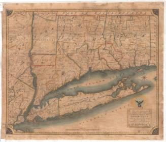
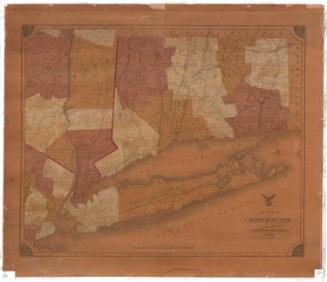

Lucius Stebbins & Co.
1859