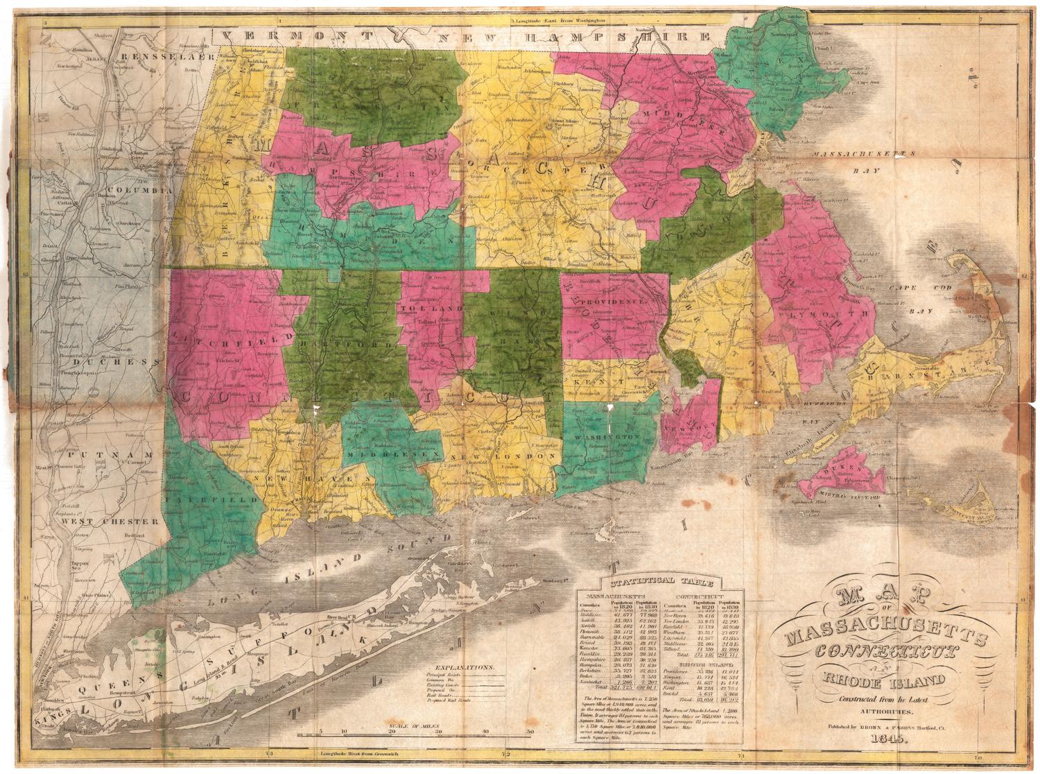
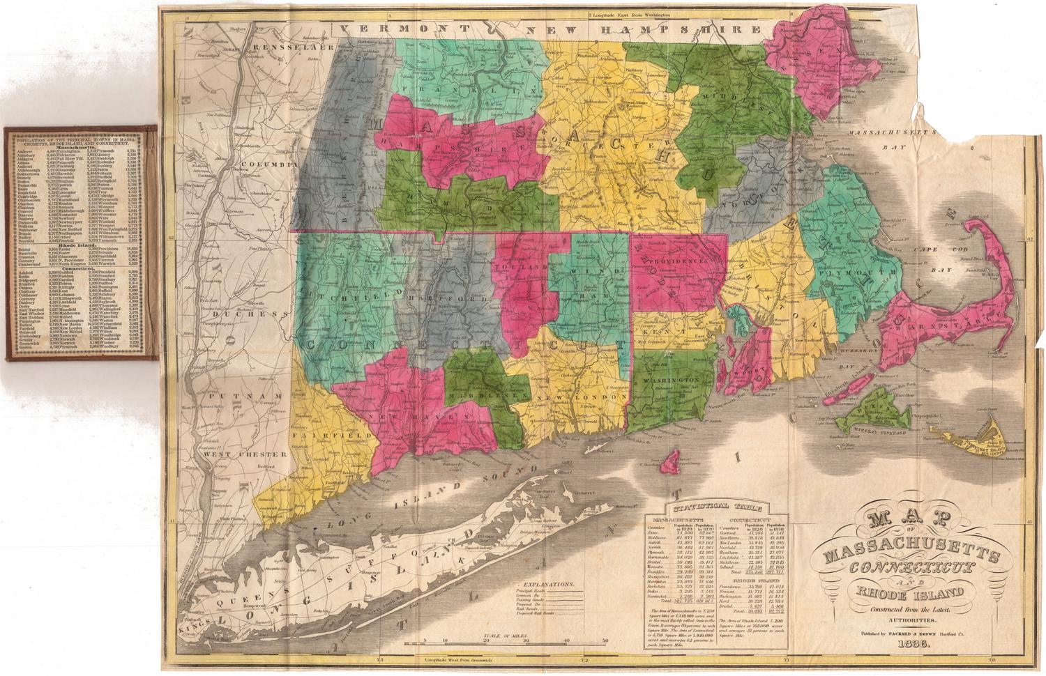
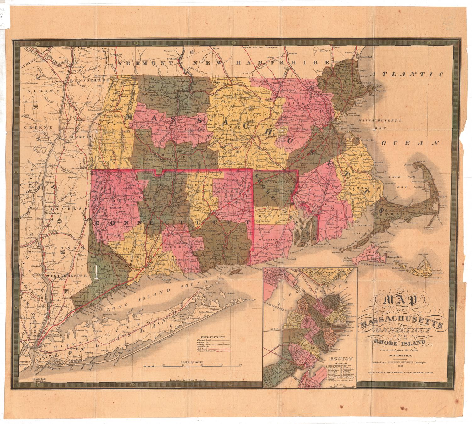
Map of Massachusetts, Rhode Island and Connecticut, Compiled From the Latest Authorities
PrintmakerEngraved by
J. Wells
(American)
PublisherPublished by
A. F. Wilcox
(American, active 1834 - 1836)
PublisherPublished by
Light & Stearns
(American)
PublisherPublished by
C. Shepard
(American)
Date1836
MediumEngraving; black printer's ink and watercolor on wove paper
DimensionsPrimary Dimensions (image height x width): 26 x 34 1/4in. (66 x 87cm)
Platemark (height x width): 27 x 36in. (68.6 x 91.4cm)
Sheet (height x width): 29 1/4 x 38in. (74.3 x 96.5cm)
ClassificationsGraphics
Credit LineConnecticut Museum of Culture and History collection
Object number2005.184.0
DescriptionMap of Massachusetts, Connecticut and Rhode Island, from the borders of Vermont and New Hampshire to the north, Massachusetts Bay and the Atlantic Ocean to the east, the Long Island Sound to the south, and the border of New York State to the west. The states are divided into counties and towns, with villages, large towns, academies, banks, court houses, light houses, and mills denoted with symbols. Insets around the map show the towns of Norwich, Connecticut; Fall River, Massachusetts; New Haven, Connecticut; Salem, Massachusetts; Lowell, Massachusetts; New Britain, Connecticut; New York, New York; Warwick and Coventry factories in Rhode Island; Hartford, Connecticut; Pawtucket and Central Falls, Rhode Island; Providence, Rhode Island; North Adams, Massachusetts; Canton, Massachusetts; and Boston, Massachusetts. On the right side are a list of references and a list of mills and factoriesThe decorative cartouche features three circles, within which are the seals of the three states depicted, and the mottos of Connecticut and Massachusetts.
Label TextLittle is known of A. F. Wilcox, who published this map of Massachusetts, Rhode Island, and Connecticut in Middletown, Connecticut in 1836. He is probably the same A. F. Wilcox who published a map of the State of Ohio in New York City two years earlier. Although Middletown was never a major publishing center, this map reflects the beginning of a regional approach to mapmaking. Not only does the map combine three adjoining states on a single sheet, it was also published in three different cities: Middletown, Connecticut; Boston, Massachusetts; and New York City. The presence of these three separate imprints suggests that the map was marketed in these three areas.
NotesCartographic Note: No scaleStatus
Not on view