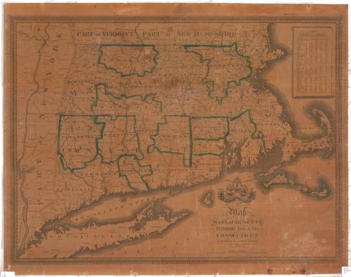
A Map of Massachusetts, Rhode Island and Connecticut
DraftsmanDrawn by
John Gould Darby
(American, 1808 - 1881)
PrintmakerEngraved by
John Gould Darby
(American, 1808 - 1881)
PublisherPublished by
Lemuel Bingham
(American)
Date1843
MediumEngraving; black printer's ink and watercolor on paper, lined with linen
DimensionsPrimary Dimensions (image height x width): 22 x 29 1/8in. (55.9 x 74cm)
Sheet (height x width): 24 x 30 1/8in. (61 x 76.5cm)
Mount (height x width): 24 x 30 1/8in. (61 x 76.5cm)
Sheet (height x width): 24 x 30 1/8in. (61 x 76.5cm)
Mount (height x width): 24 x 30 1/8in. (61 x 76.5cm)
ClassificationsGraphics
Credit LineMuseum purchase
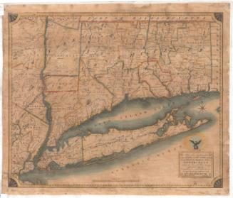
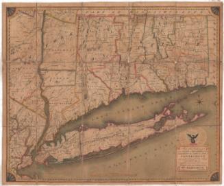
DescriptionMap of Massachusetts, Connecticut and Rhode Island, with the state borders of Vermont and New Hampshire to the north, the Atlantic Ocean to the east and south, and part of New York State to the west. The land is divided into counties, labeled and outlined with broken solid lines and colored pink or blue; and towns, labeled and outlined with solid black lines. Physical features depicted include mountains, conveyed through hachure marks; rivers, which are labeled; and lakes, some of which are labeled. To the right of the map is a table listing the distances between various towns in Massachusetts, Rhode Island and Connecticut and Boston, Providence, Hartford, New Haven and New York. Above the title text, the cartouche features the seals of the three states depicted; the Rhode Island and Connecticut seals also bear the states' mottos, "Hope," and "Qui transtulit sustinet," respectively. Above the Massachusetts seal is its state motto, "Ense petit placidam sub libertate quietem." Below the seals are two cornucopias or horns of plenty.
Object number1990.179.0
NotesCartographic Note: Scale: 5 3/8 inches equals 40 milesOn View
Not on view


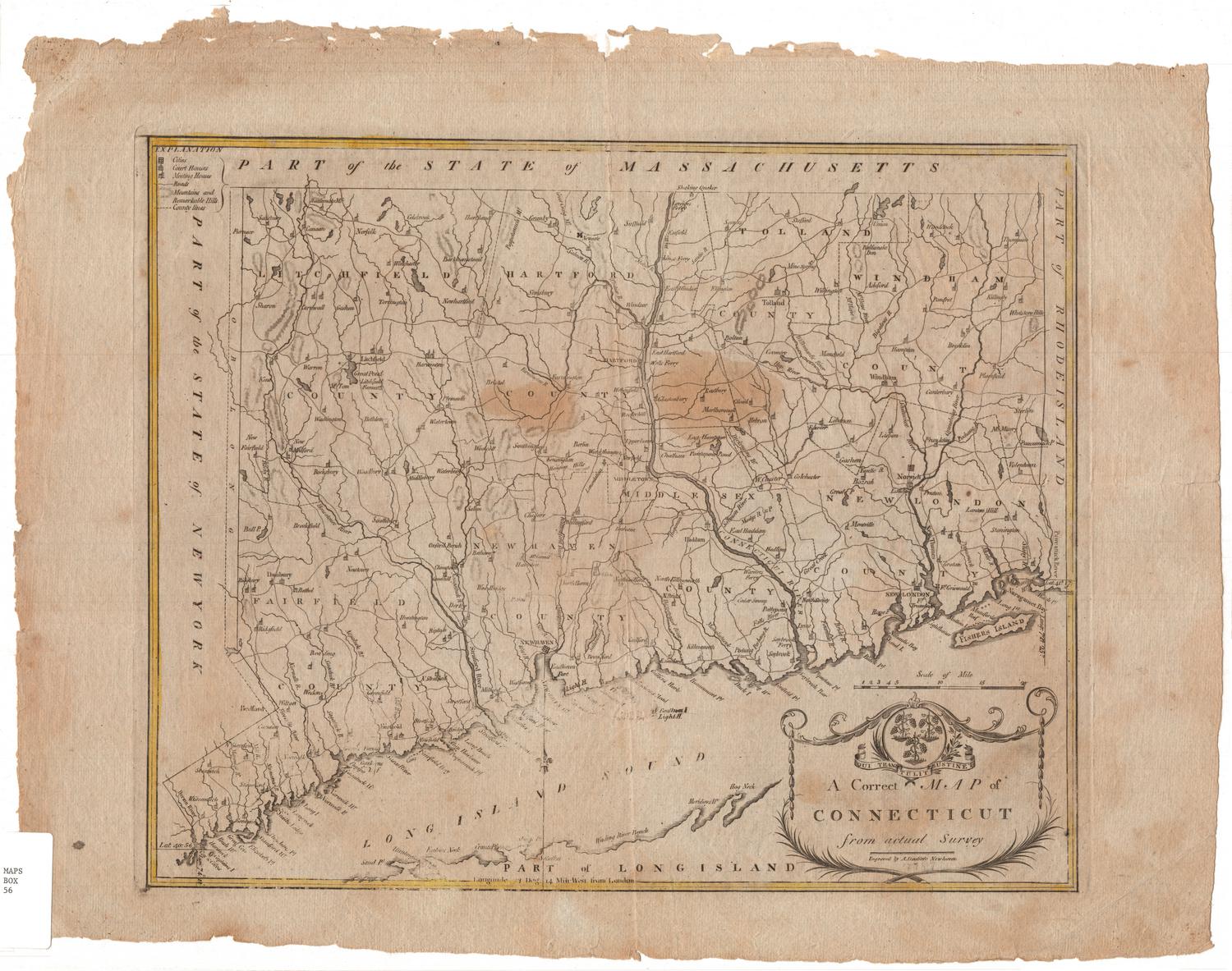


H. F. Sumner & Co.
1833
Object/Object