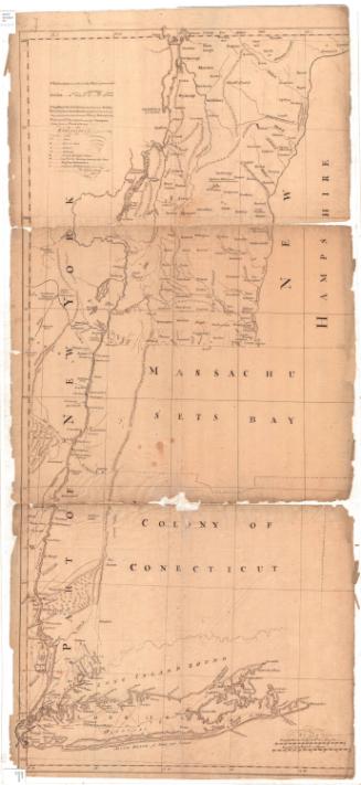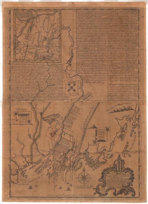
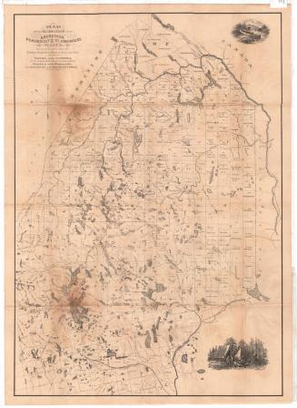
This Plan of Kennebeck and Sagadahock Rivers and Country adjacent...
PrintmakerEngraved by
Thomas Johnston
(American, 1708 - 1767)
PrinterPrinted by
Thomas Johnston
(American, 1708 - 1767)
Date1754
MediumEngraving; black ink on laid paper, lined with linen
DimensionsPrimary Dimensions (image height x width): 31 3/8 x 22in. (79.7 x 55.9cm)
Sheet (height x width): 32 3/4 x 23 3/4in. (83.2 x 60.3cm)
Mount (height x width): 32 3/4 x 23 3/4in. (83.2 x 60.3cm)
ClassificationsGraphics
Credit LineConnecticut Museum of Culture and History collection
Object number1991.190.0
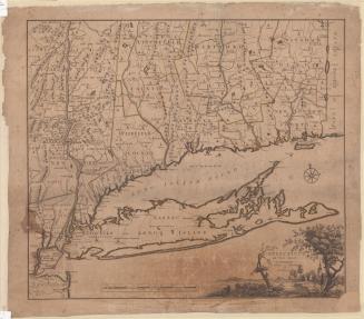
DescriptionMap of what is now coastal Maine, oriented east-west so that Cape Elizabeth is to the west and Penobscot Bay to the east. Islands, points, necks, waterfalls and rivers are depicted, particularly the Sagadahock and Kennebeck Rivers. Forts Western, Frankfort and Halifax, along the Kennebec River, are are shown, along with information about when the fort was built and by whom. The Penobscot Mountains are shown in profile. At the top of the sheet there is a map showing parts of New England, New York State and Canada, from the St. Lawrence River to the north, the "north east part of Massachusetts" to the east, parts of Connecticut, Rhode Island and New York to the south, and Lake Ontario to the west. The rest of the sheet is blocks of text that describe the lands shown and provide some historical context. The cartouche is decorative and features the Latin phrase, "Pro rege et republica" inscribed below a flag or shield with six stripes and five small symbols. Above this is a figure who appears to be kneeling.
Label TextThomas Johnston published this map in Boston in 1754, just as war was breaking out between France and England. The rivers shown on the map would play a crucial role in the coming conflict. Both the Kennebec River, shown on the main map, and the Hudson River, shown in the inset, provided water routes between French Canada and the British colonies, that were used by forces on both sides. The Connecticut River was used to a lesser extent, since it did not provide such direct access to the Canadian interior. One Indian raid took place at Fort Number Four, located on the river in what is now Charlestown, New Hampshire, in 1754, at the outbreak of the war.
NotesCartographic Note: Scale: About 2 3/8 inches equals 10 milesStatus
Not on view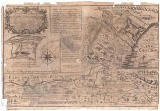
Thomas Sedgwick Steele
1881