New Haven Harbor, Connecticut, Sheet A
SurveyorSurveyed by
Richard Meade Bache
(American, 1830 - 1907)
SurveyorSurveyed by
George Benjamin Chittenden
(American, 1849 - 1939)
PublisherPublished by
United States Coast Survey
(American, founded 1807)
Date1872
MediumLithography; black printer's ink on wove paper
DimensionsPrimary Dimensions (image height x width): 21 5/8 x 30 3/8in. (54.9 x 77.2cm)
Sheet (height x width): 24 x 32 1/4in. (61 x 81.9cm)
ClassificationsGraphics
Credit LineConnecticut Museum of Culture and History collection
Object number2012.312.190.2
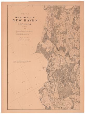
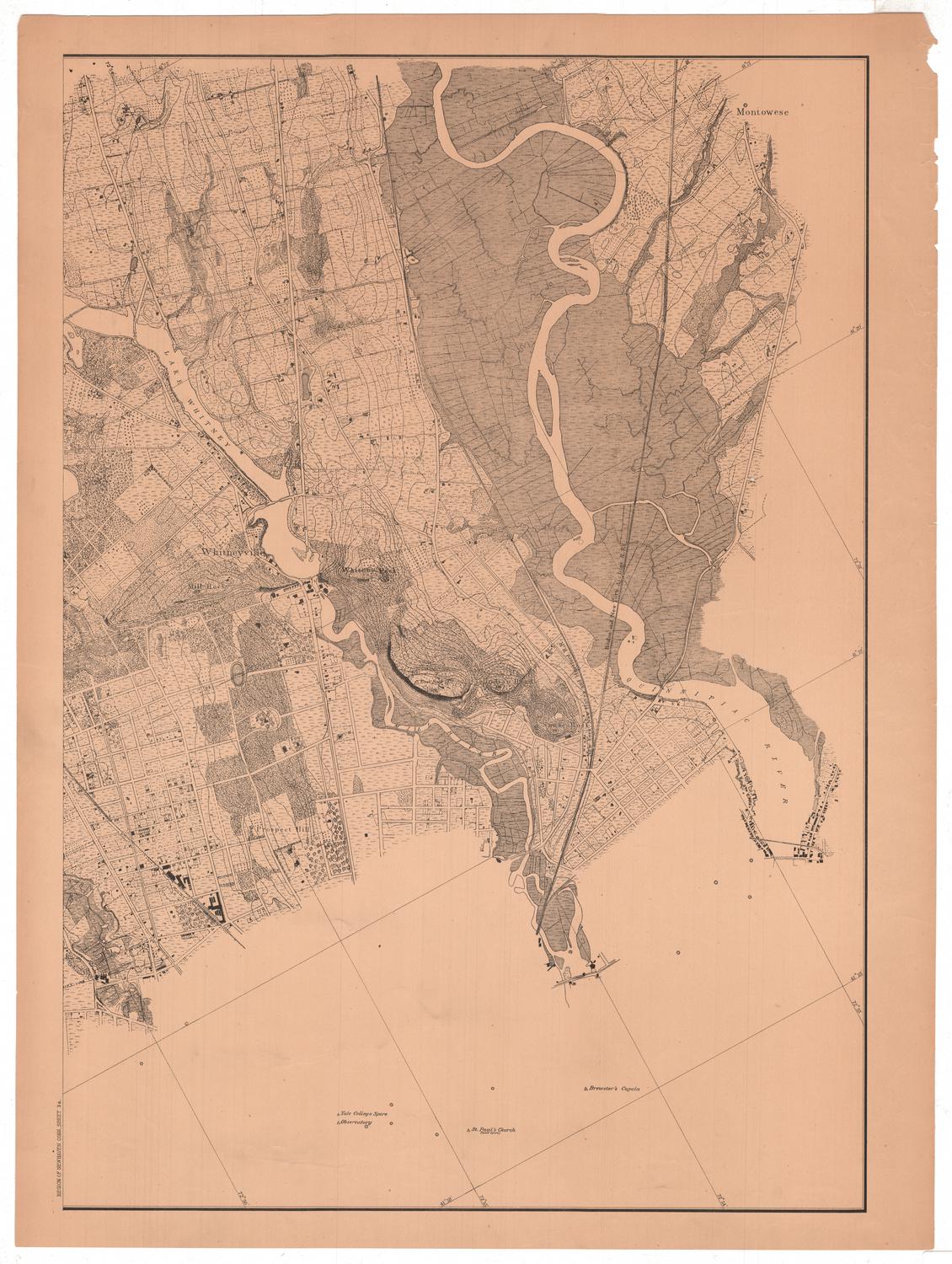
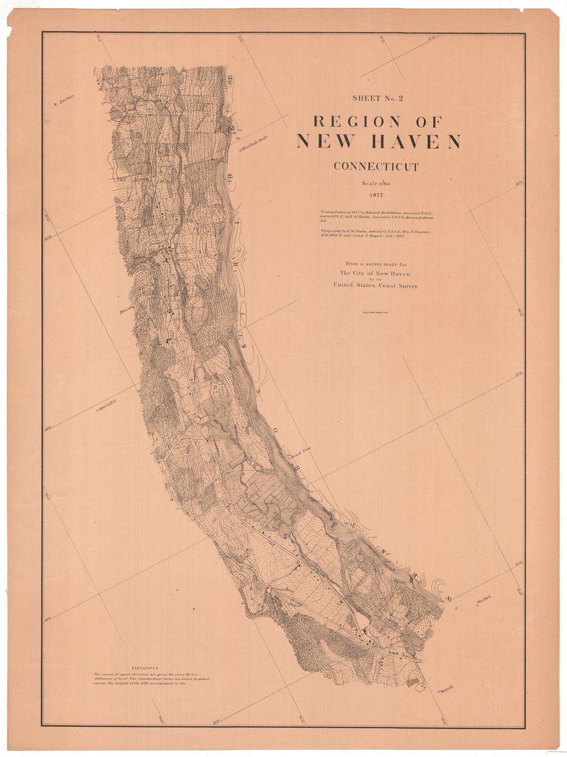
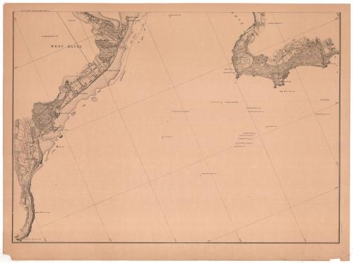
DescriptionMap of the New Haven, Connecticut, harbor and the land around it, from a cove to the north, Round Rock buoy to the east, Luddington's Rock buoy to the south, and West Haven to the west. Some of the city streets are laid out but not labeled, and buildings, presumably including dwellings and businesses, are indicated with black rectangles. Notable man-made features and landmarks, such as cupolas, the Sea View House, light houses and flags are marked and labeled. A variety of lines indicates different types of and uses for land, none of which are explained. In the water part of the map, signals, buoys, and a spindle are marked and labeled. Water depth is not included.
Label TextThe city of New Haven is located on a large harbor formed by the confluence of the Quinnipiac, the Mill River, and the West River. The outer harbor is four miles wide, and the city is located about four miles from its entrance. The shallow water of the harbor was a problem; New Haven was a major port during the 1800s and traffic in and out of the harbor was heavy. The United States Coast Survey conducted regular surveys and produced detailed maps that document the changes in coastal areas such as New Haven Harbor. Though this sheet is unsigned, it is part of a two-sheet map and the other sheet indicates that George Benjamin Chittenden, a young man from nearby Madison, Connecticut, was an assistant on the project. Chittenden went on to a distinguished career with the United States Geological and Geographical Survey of the Territories under Ferdinand V. Hayden.
NotesCartographic Note: No scaleStatus
Not on view