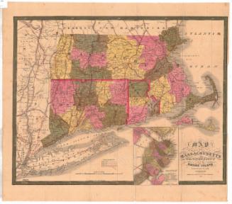
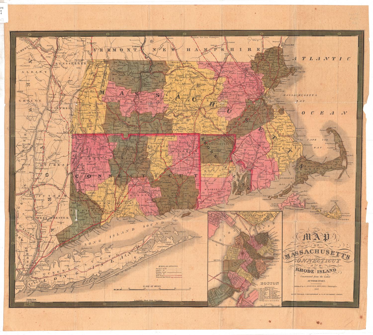
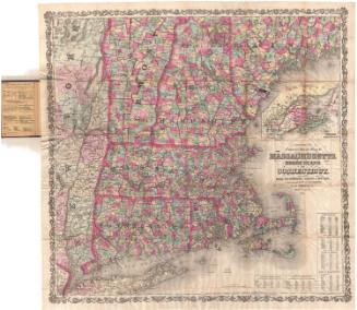
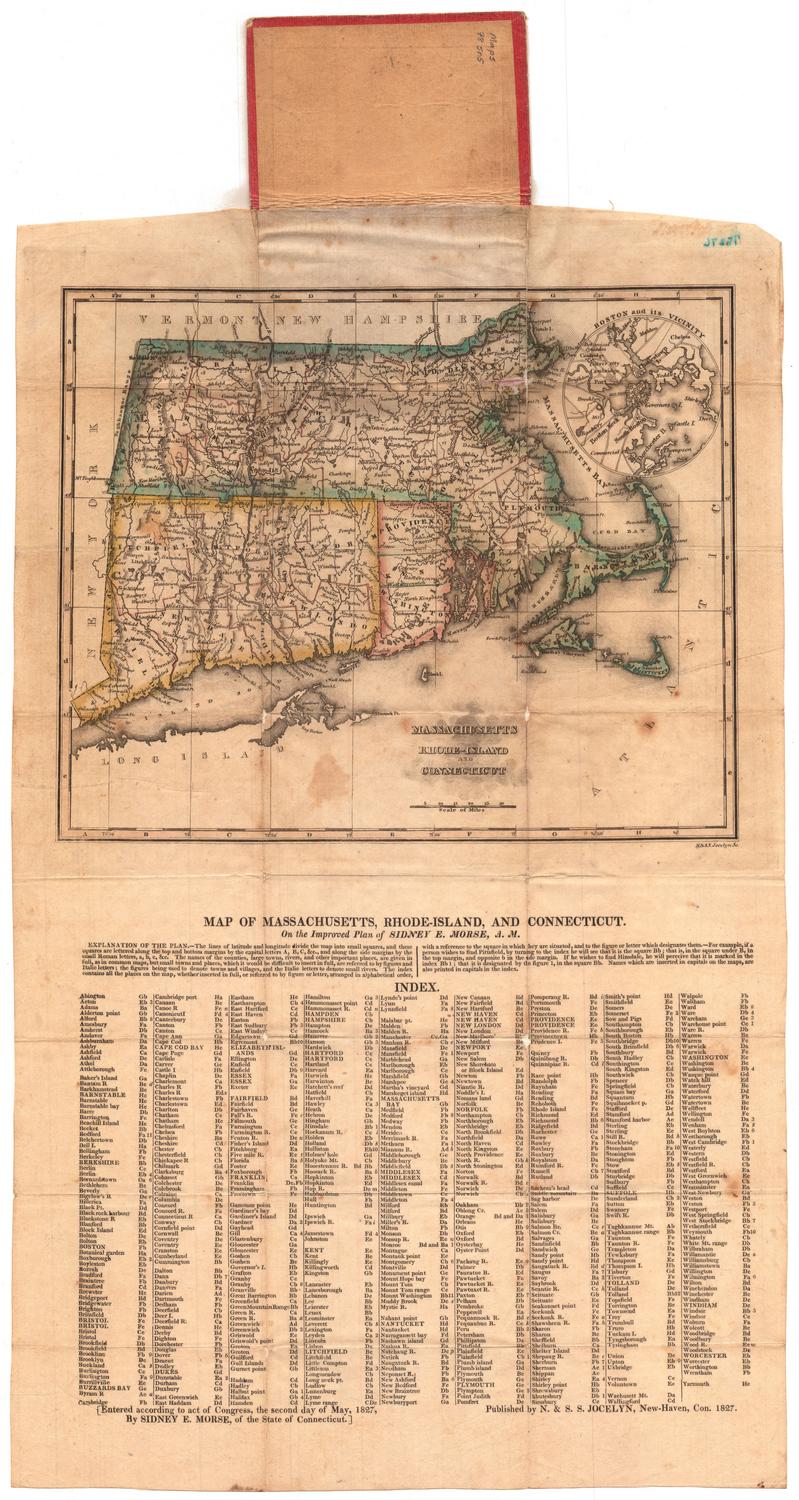
Massachusetts, Rhode Island and Connecticut
PrintmakerEngraved by
J. M. Atwood
(American, active about 1840 - 1875)
PublisherPublished by
Frank A. Gray
(American, 1852 - 1886)
Date1875
MediumLithography; black and colored printer's inks on wove paper
DimensionsPrimary Dimensions (image height x width): 15 3/8 x 25 3/8in. (39.1 x 64.5cm)
Sheet (height x width): 17 1/4 x 27 1/8in. (43.8 x 68.9cm)
ClassificationsGraphics
Credit LineMuseum purchase
Object number1982.129.4
DescriptionMap of Massachusetts, Rhode Island, and Connecticut, with part of New York to the west, parts of Vermont and New Hampshire to the north, the Atlantic Ocean to the east, and the Atlantic Ocean, Block Island, Long Island Sound and part of Long Island to the south. Counties, cities, towns, major rivers, and railroads are shown. The locations of light ships and lighthouses are indicated. An inset map of the Environs of Boston is at the upper right.
Label TextFrank A. Gray was the son of map publisher Ormando Willis Gray. He went into business with his father in the 1870s. This double-page spread showing Massachusetts, Rhode Island, and Connecticut, probably appeared in Gray's Atlas of the United States in 1875. Despite its large size it does not convey as much geographical information as many smaller maps, and the patchwork color scheme is confusing, making it difficult to distinguish between the three states.
NotesCartographic Note: 1 inch = 9 milesMedium Note: Although J. M. Atwood appears as the engraver of this map, Atwood's engraving would have been reproduced using transfer lithography.
Status
Not on view