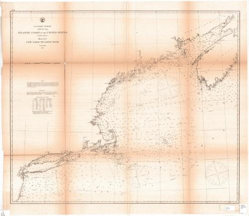
Atlantic Coast of the United States
PublisherPublished by
United States Coast Survey
(American, founded 1807)
MakerMade by
Alexander Dallas Bache
(American, 1806 - 1867)
Date1863-1864
MediumLithography; black printer's ink on wove paper
DimensionsPrimary Dimensions (image height x width): 23 1/2 x 27 13/16in. (59.7 x 70.6cm)
Sheet (height x width): 26 x 29 7/8in. (66 x 75.9cm)
Sheet (height x width): 26 x 29 7/8in. (66 x 75.9cm)
ClassificationsGraphics
Credit LineMuseum purchase
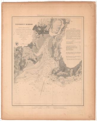
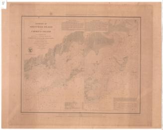
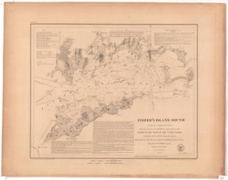
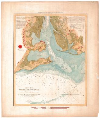
DescriptionChart of the Atlantic Coast, from Cape Sable to the east, at the tip of Nova Scotia, to Sandy Hook to the west, along the coast of New Jersey. Water depth is expressed in fathoms, and a variety of bottom conditions are noted -- materials, colors and shades, and textures. Islands, shoals, banks, and ledges are some of the natural features depicted. Land is outlined, with black shaded areas denoting population centers.
Object number1982.129.2
NotesCartographic Note: Scale: 1:1,200,000On View
Not on view