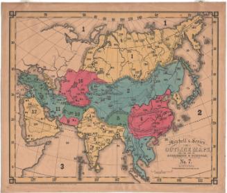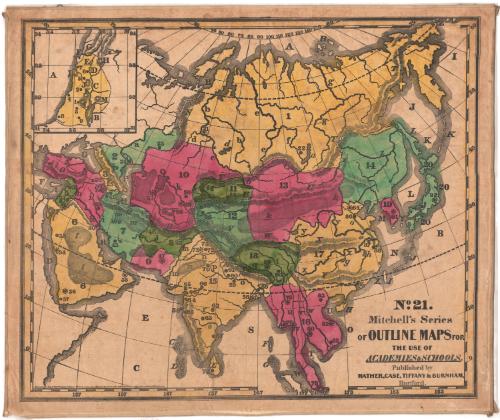
Asia
PrinterPrinted by
Mather, Case, Tiffany & Burnham
(American, active 1841)
Date1841
MediumLithography; black printer's ink and watercolor on paper, lined with linen
DimensionsPrimary Dimensions (image height x width): 23 1/8 x 27 1/4in. (58.7 x 69.2cm)
Sheet (height x width): 24 3/8 x 28 3/4in. (61.9 x 73cm)
Mount (height x width): 24 3/4 x 29 1/8in. (62.9 x 74cm)
ClassificationsGraphics
Credit LineConnecticut Museum of Culture and History collection
Object number2012.312.222.20
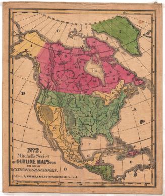
DescriptionMap of Eastern Europe, the Middle East, India and the Far East. The countries are not labeled; instead, they are numbered. There are also smaller numbers and circles that correspond with a key published separately from the map. Natural features include elevation, depicted with hachure marks; deserts, depicted with clusters of dots; rivers and islands.
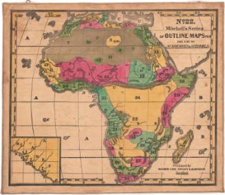
Label TextThe Key for Exercise on Mitchell's Series of Outline Maps provided an extensive list of questions for teachers to use when presenting this map of Africa to their students in a classroom setting. Although the questions are wide-ranging in their scope, particular emphasis is placed on the geography of Palestine, which is shown in a separte inset to allow for greater detail, and is identified as "the honored spot where the great tragedy of the life, sufferings, and death of our blessed Saviour was acted." The author of the Key assumed that virtually all the students using this map would be Christians, though this was not necessarily the case.
NotesCartographic Note: No scaleStatus
Not on view