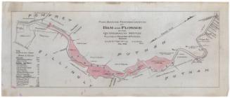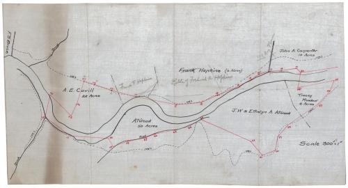
Quinebaug River, Killingly, Connecticut
SurveyorProbably surveyed by
Erastus Worthington
(American, 1863 - 1953)
Date1908
MediumDrawing; black and red ink on drafting cloth
DimensionsPrimary Dimensions (image height x width): 10 x 18 3/4in. (25.4 x 47.6cm)
Sheet (height x width): 10 x 18 3/4in. (25.4 x 47.6cm)
ClassificationsGraphics
Credit LineConnecticut Museum of Culture and History collection
Object number2012.312.230
DescriptionMap of the Quinebaug River and owned land along it as it flows through portions of Killingly, Connecticut. Lots are labeled with the owner's name, a sketch of any existing fences or stone walls, and a broken solid line marking the flow line. Property owners include F.S. Bruce, A.E. Covill, Atwood, Frank Hopkins, J.W. and Ethelyn A. Atwood, John A. Carpenter and Tracey Meadow. There is a red line marked with numbers from 4-20 north of the river and 54-72 south of it, which no explanation for the significance.
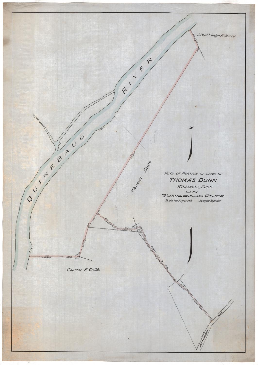
Label TextJ. W. Etheylyn A. Atwood, John A. Carpenter, A. E. Covill, and Frank Hopkins, whose names appear on this map, are all listed as owning property within the area of flowage of a proposed dam on the Quinebaug River on a larger map by Erastus Worthington, a civil engineer from Providence, Rhode Island. This small map may be a sketch for that larger map. Worthington specialized in water supply and sewage systems and designed such systems for many towns in New England during the first part of the twentieth century.
NotesCartographic Note: Scale: 1 inch equals 300 feetStatus
Not on view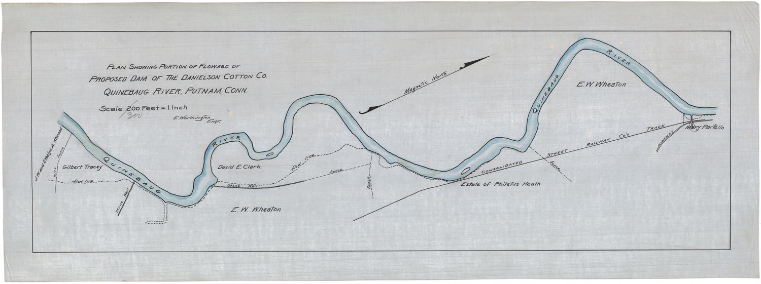
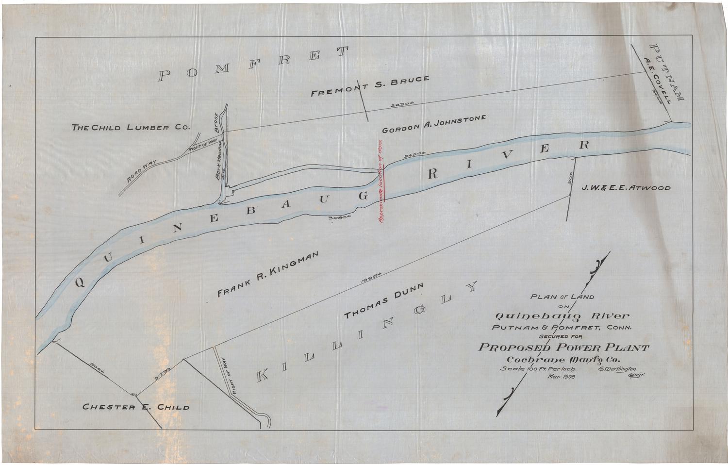
Erastus Worthington
1907