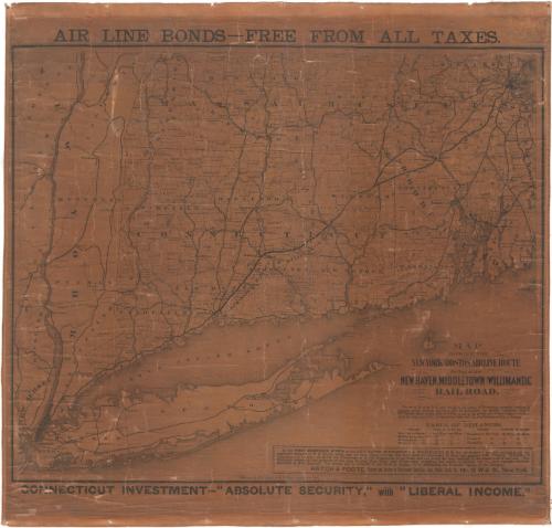
Map showing the New York and Boston airline route by way of the New Haven, Middletown and Willimantic Rail Road
DraftsmanDrawn by
Unknown
PublisherPublished by
H. H. Lloyd & Co.
(American, 1860 - 1878)
Datebefore 1876
MediumLithography; black printer's ink on wove paper mounted on linen
DimensionsPrimary Dimensions (image height x width): 22 3/4 x 28 3/8in. (57.8 x 72.1cm)
Sheet (height x width): 27 1/8 x 29 1/4in. (68.9 x 74.3cm)
ClassificationsGraphics
Credit LineConnecticut Museum of Culture and History collection
Object number2012.312.225
DescriptionMap of Connecticut with adjoining portions of New York, Massachusetts, Rhode Island, and Long Island. Towns throughout Connecticut, Massachusetts, and Rhode Island are indicated. Railroad stations on the New Haven, Middletown and Willimantic Railroad are indicated. The New Haven, Middletown and Willimantic Railroad is shown as a heavy black line. Other railroads, including the New York, New Haven and Hartford Railroad; the Boston and Albany Railroad; the Hartford, Providence and Fishkill Railroad; the Stonington and Providence Railroad; the Naugatuck Railroad, and the Housatonic Railroad are shown as narrower black lines. A long text extolling the benefits of investing in the airline railroad is printed at lower right.
Label TextConnecticut has always been viewed as a transportation corridor between the major cities of New York and Boston. During the nineteenth century, railroads, steamboats, and highways, often in combination, offered a variety of different routes, but none were as direct or offered the same potential for speed as the so-called "air line route" which cut diagonially across the state, passing through Middletown and Willimantic and bypassing Hartford. The route was proposed as early as 1846, but by 1873 had only been completed as far as Willimantic. Not until 1891 was passenger service offered all the way to Boston. This map evidently served as poster to promote the sale of bonds to finance the airline railroad.
NotesCartographic Note:Status
Not on view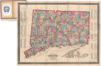


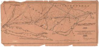
Lucius Stebbins & Co.
1859