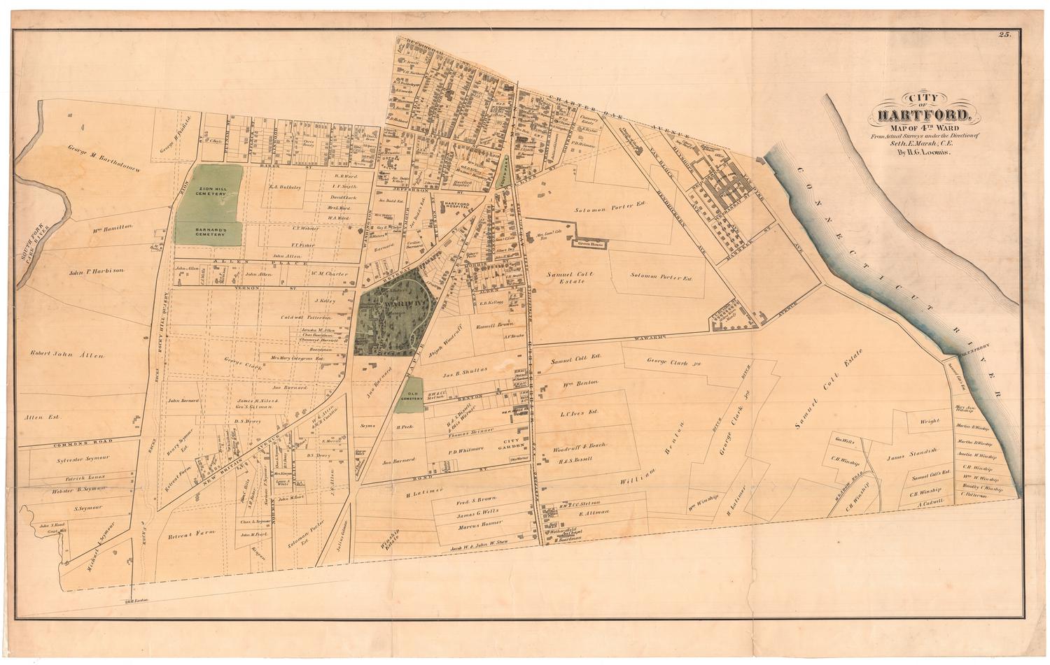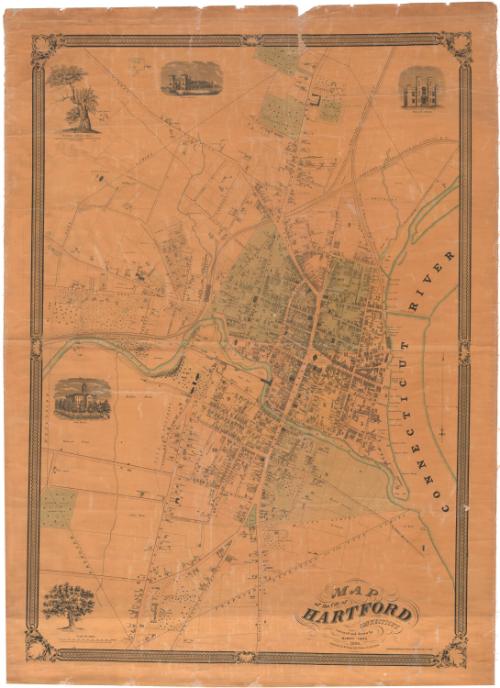
Map of the City of Hartford, Connecticut
SurveyorSurveyed by
Marcus Smith
(possibly British, born about 1810)
DraftsmanDrawn by
Marcus Smith
(possibly British, born about 1810)
PrinterPrinted by
Mayer & Korff
(American, 1849 - 1851)
PublisherPublished by
Matthew Dripps
(American, 1818 - 1896)
Date1850
MediumLithography; printer's ink and watercolor on wove paper mounted on linen
DimensionsPrimary Dimensions (image height x width): 44 1/2 x 31 1/2in. (113 x 80cm)
Sheet (height x width): 48 1/4 x 35 1/2in. (122.6 x 90.2cm)
Sheet (height x width): 48 1/4 x 35 1/2in. (122.6 x 90.2cm)
ClassificationsGraphics
Credit LineConnecticut Museum of Culture and History collection
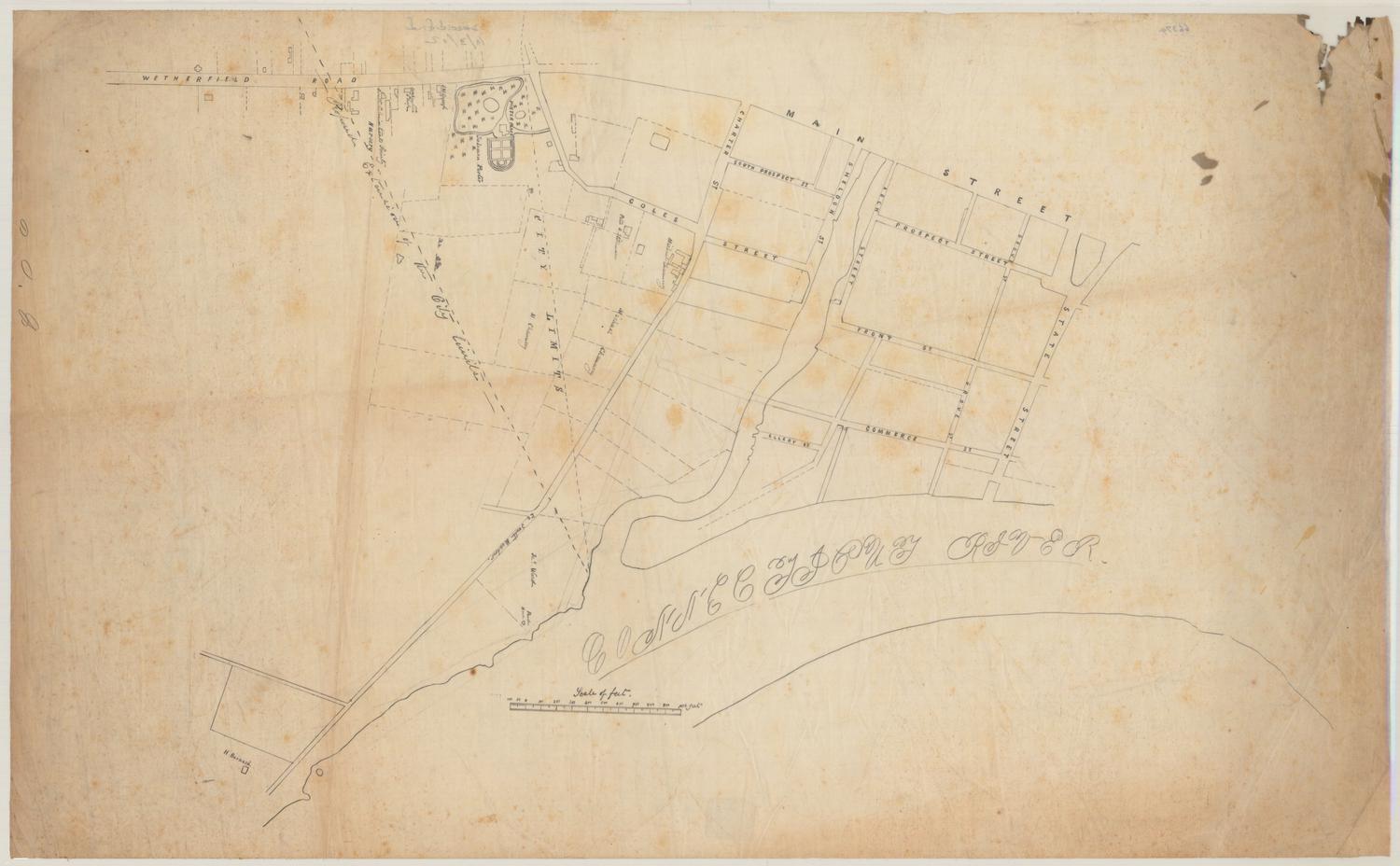
DescriptionMap of the city of Hartford from Spring Grove Cemetery to the north, the residence of James Dixon and Zion Hill Cemetery to the west, just beyond the Retreat for the Insane to the south, and the Connecticut River to the east. Prominently shown are the Little River or Mill River (now the Park River), Union Station, the Hartford and New Haven Railroad, the Hartford and Springfield Railroad, the Hartford, Providence and Fishkill Railroad, the steamboat dock, and other docks. The existing city limits and the proposed extension of the city limits are both shown. Vigenettes depict the Charter Oak, the (Old) State House, the Pearmain Apple Tree (brought from England by George Wyllys), and the Wadsworth Atheneum.
Object number2012.312.224
NotesCartographic Note: 1 inch = 300 feetOn View
Not on view