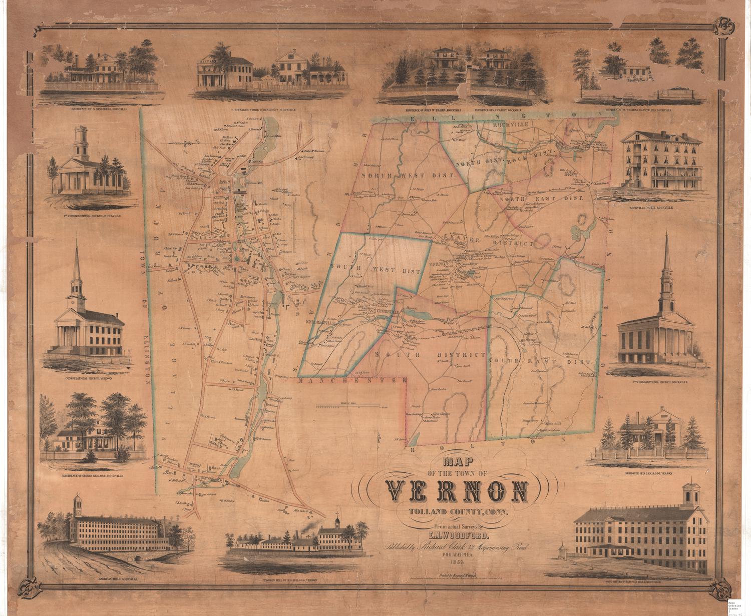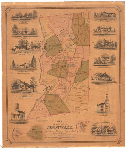
Map of the Town of Cornwall, Litchfield County, Connecticut
SurveyorSurveyed by
L. Fagan
(American, born about 1825)
DraftsmanDrawn by
L. Fagan
(American, born about 1825)
PrinterPrinted by
Wagner & McGuigan
(American, 1845 - 1859)
PublisherPublished by
Richard Clark
(American)
Date1854
MediumLithography; printer's ink and watercolor on wove paper mounted on linen
DimensionsPrimary Dimensions (image height x width): 38 1/2 x 32 5/8in. (97.8 x 82.9cm)
Sheet (height x width): 41 1/2 x 35 1/4in. (105.4 x 89.5cm)
ClassificationsGraphics
Credit LineMuseum purchase
Object number1956.95.1
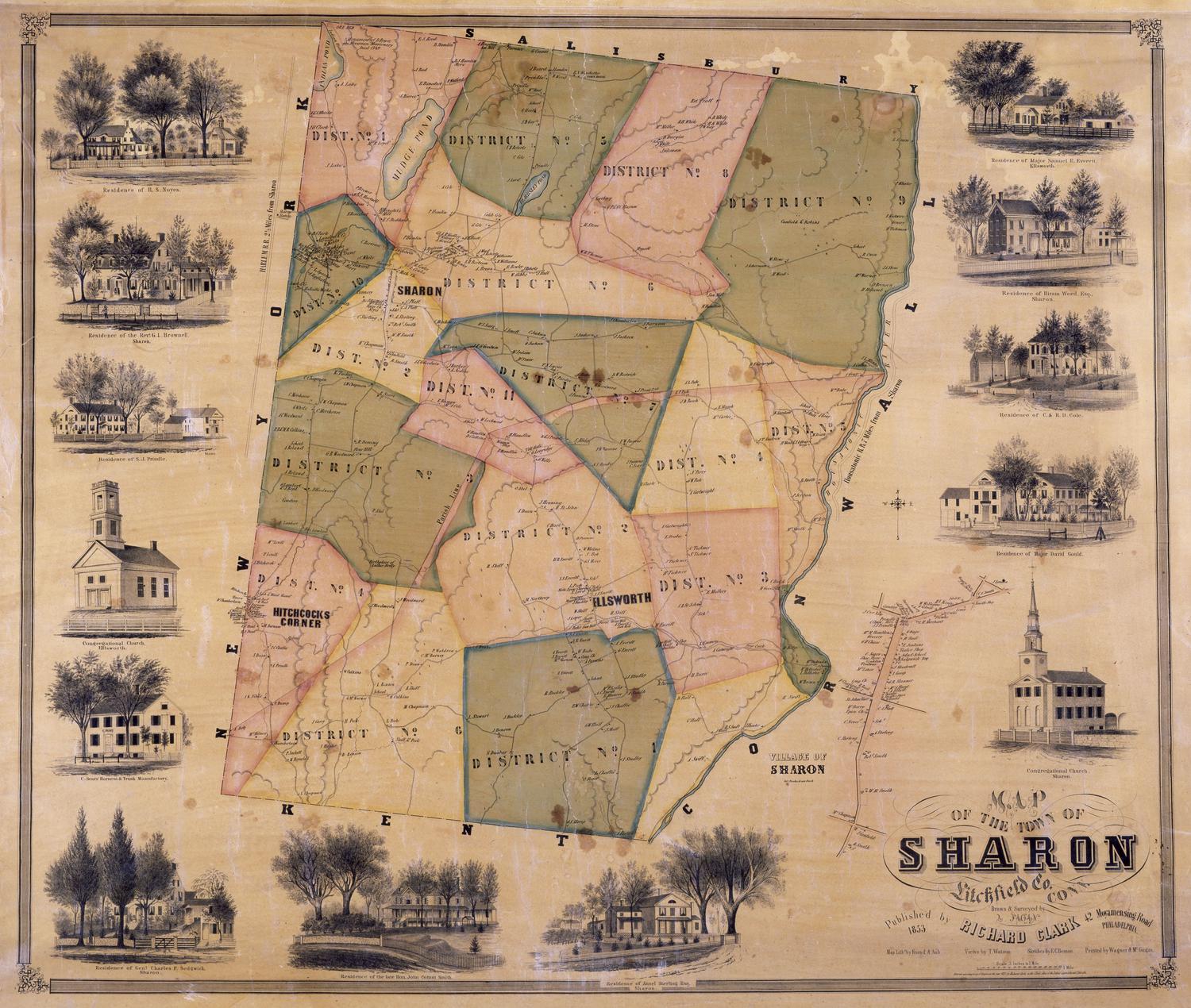
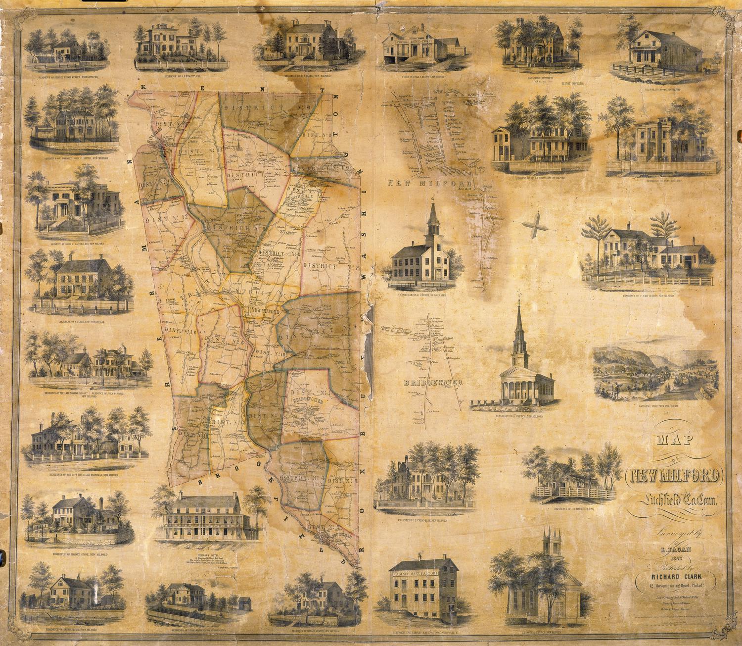
DescriptionMap of Cornwall, Connecticut, with the town of Canaan to the north, Goshen to the east, Warren and Kent to the south, and Sharon to the west. Small inset maps show the villages of Cornwall, Cornwall Bridge, and West Cornwall. The town is divided into fifteen numbered districts. Roads, streams, ponds, and mountains are shown. Elevation is indicated with hachure marks. Small trees are used to indicate wooded areas, suggesting that much of the town was deforested. Names of property owners and businesses are indicated. Vignettes show the Congregational Church, Cornwall; the residence of Noah Rogers (North Cornwall); the Residence of Julius Beardsley (Cornwall); the Adelphic Institute, residence of Ambrose S. Rogers; Residence of Col. D. W. Pierce (Cornwall); Cream Hill School, residence of S. W. & T. S. Gold; residence of Isaac Marsh (Cornwall); the Dr. J. A. Welch Alger Institute (Cornwall); the residence of Jacob Scovill (North Cornwall); the residence of Daniel S. Scovill (West Cornwall); the residence of Dr. J. H. Welch; the North Congregational Church; and the store and residence of Pratt & Foster (West Cornwall).
Label TextLarge impressive homes and schools, many of them in the Greek revival style, appear in the margins of this large impressive map of Cornwall, Connecticut. In the nineteenth century, Cornwall was famous for its schools, including the Foreign Mission School, which had closed in 1820; the Cream Hill Agricultural School; and the Adelphic Institute and the Alger Institute, both private boys' boarding schools. Cornwall was also famous for its iron works, the Cornwall Iron Company and the Cornwall Bridge Iron Company. These existence of these industries contradicts the gracious image that the map projects and they do not appear at all prominently on it. Only the fact that the area appears to have been largely deforested seems to allude to presence of the iron furnaces, which relied upon local charcoal for fuel.
NotesCartographic Note: 3 inches = 1 mileStatus
Not on view