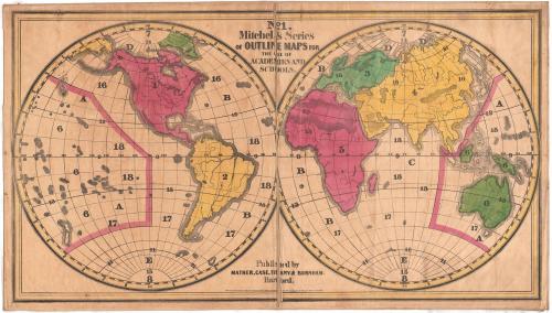
Eastern and Western Hemispheres
PrinterPrinted by
Mather, Case, Tiffany & Burnham
(American, active 1841)
Date1841
MediumLithography; black printer's ink and watercolors on paper, lined with linen
DimensionsPrimary Dimensions (image height x width): 27 1/8 x 48 3/4in. (68.9 x 123.8cm)
Sheet (height x width): 28 1/2 x 50in. (72.4 x 127cm)
Mount (height x width): 29 x 50 1/4in. (73.7 x 127.6cm)
ClassificationsGraphics
Credit LineConnecticut Museum of Culture and History collection
Object number2012.312.222.1
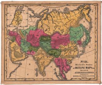
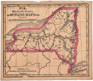
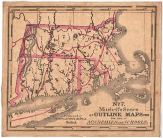
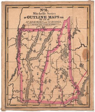
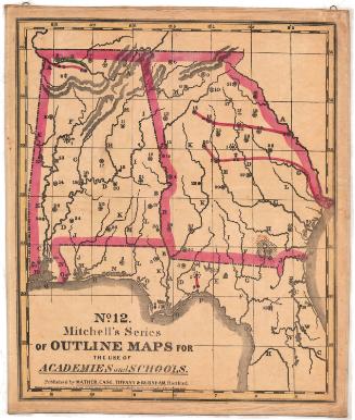
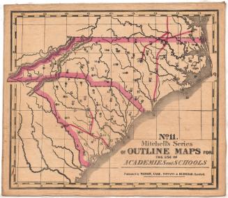
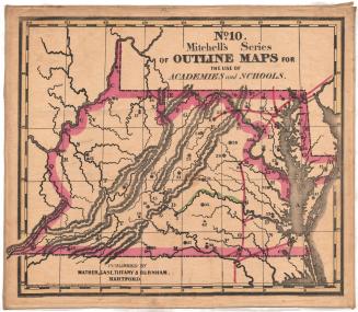
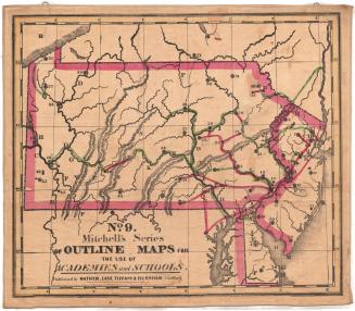
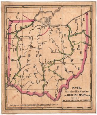
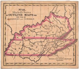
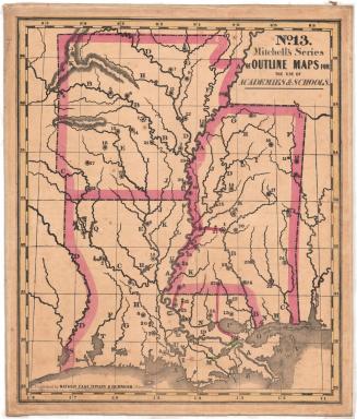
DescriptionMap of the world, divided into the western and eastern hemispheres.The continents are outlined and colored. There are numbers and letters on the land and water areas that correspond with information in the key, published separately from the map.
Label TextMitchell's Outline Maps were designed to be used in the teaching of geography in schools. This large world map was supposed to teach students about latitude and longitude, about the poles, the equator, circles (the Arctic Circle, the Antarctic Circle, the Tropics of Cancer and Capricorn) and zones (the "Frigid" Zones, the Temperate Zones, and the Tropics), but the key to this map also raised questions about political divisions, races of men, stages of society, religion, and language. Mitchell wanted teachers to use his maps to teach their students to think about broader issues, not just to memorize facts about physical geography.
NotesCartographic Note: No scaleSubject Note: In 1845, Second North School in Hartford, Connecticut, had a set Mitchell's Series of Outline Maps for use in the teaching of geography. In 1858, five Hartford school districts had outline maps, but it is not clear if these were Mitchell's maps or the products of some other map publisher. These maps appear to have been commonly used and it seems like that many other Hartford and Connecticut schools of this period had and used them.
Status
Not on view