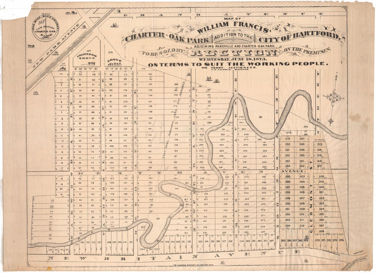
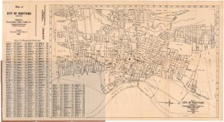
Map of William Francis' Charter-Oak Park Addition to the City of Hartford
SurveyorSurveyed by
Hiram G. Loomis
(American, 1834 - 1911)
PrinterPrinted by
Kellogg & Bulkeley
(American, 1867 - 1990)
Date1873
MediumLithography; black printer's ink on wove paper
DimensionsPrimary Dimensions (image height x width): 21 x 26 1/4in. (53.3 x 66.7cm)
Sheet (height x width): 22 x 30 1/8in. (55.9 x 76.5cm)
Sheet (height x width): 22 x 30 1/8in. (55.9 x 76.5cm)
ClassificationsGraphics
Credit LineConnecticut Museum of Culture and History collection
DescriptionMap of 374 lots in Charter Oak Park from Grand Avenue to the north, Clermont Street to the east, New Britain Avenue to the south, and Oakwood Avenue to the west. The Park River runs through the center of the addition; and the Hartford, Providence and Fishkill, and New York, New Haven and Hartford Rail Roads run across the top left corner of the map. The Hartford/West Hartford town line runs diagonally between Reed and Newfield Avenues. In the top left corner, there is a circular seal with the phrase "One Mile Race Course" around its outer edge, and an American flag and the words "Fair Ground Charter-Oak Park" inside. In the bottom right corner, the original map has had an addition pasted over it that includes the New Britain Electric Railway line, shifts Clermont Street over to the west, and reduces the sizes of the lots.
Object number1991.189.0
NotesCartographic Note: No scaleOn View
Not on view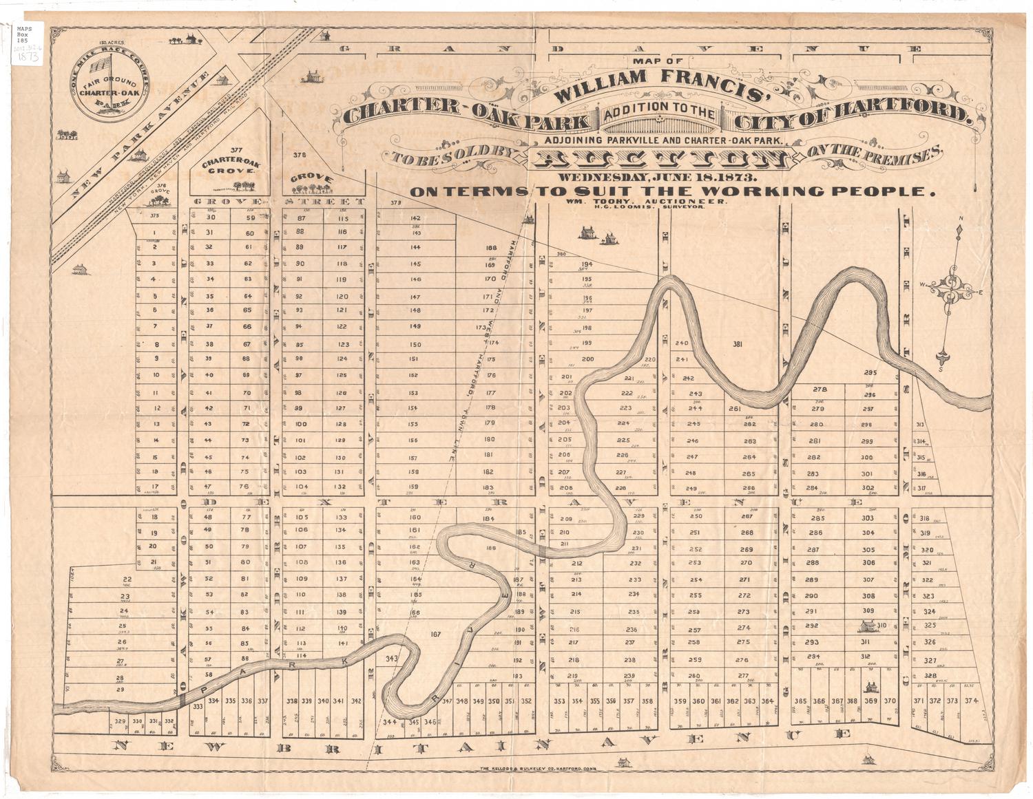

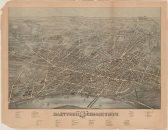
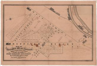
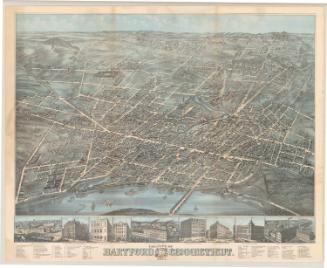
O.H. Bailey and Company