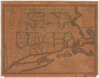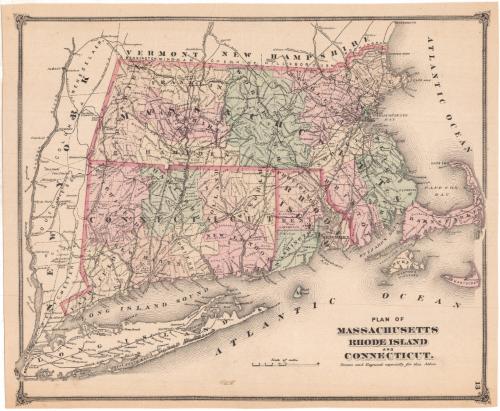
Plan of Massachusetts, Rhode Island and Connecticut
PublisherPublished by
Frederick W. Beers
(American, 1839 - 1933)
Date1874
MediumLithography; black printer's ink and watercolor on wove paper
DimensionsPrimary Dimensions (image height x width): 11 3/4 x 14 3/8in. (29.8 x 36.5cm)
Sheet (height x width): 12 1/8 x 14 3/4in. (30.8 x 37.5cm)
Sheet (height x width): 12 1/8 x 14 3/4in. (30.8 x 37.5cm)
ClassificationsGraphics
Credit LineMuseum purchase
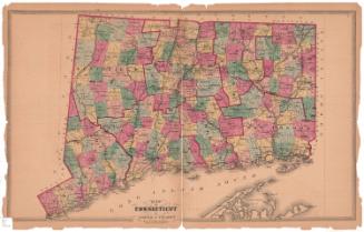
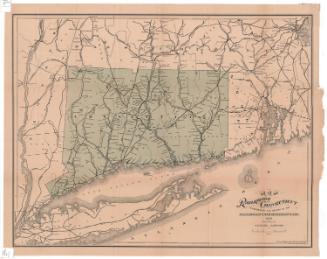
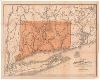
DescriptionMap of Massachusetts, Connecticut and Rhode Island, with the state borders of Vermont and New Hampshire to the north; the Atlantic Ocean to the east; Long Island, the Long Island Sound and the Atlantic Ocean to the south; and part of New York State to the west. The land is divided into counties, labeled and outlined with broken solid lines; and towns, labeled and outlined with thin broken solid black lines. Cities are denoted with open circles. Railroads, labeled and depicted as solid black lines, include the New York and New Haven; Boston, Hartford and Erie; Housatonic; Naugatuck; New Haven and Northampton; New Haven, Hartford and Springfield; New York and Boston Air Line; New London Northern; and the Norwich and Worcester Railroads.
Object number1980.100.22
NotesCartographic Note: Scale: 1 inch equals 15 milesOn View
Not on view