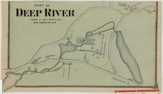
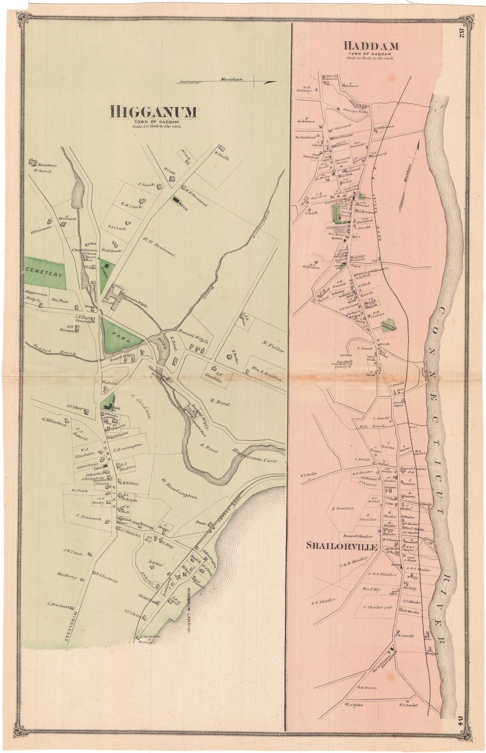
Deep River. Town of Saybrook
PublisherPublished by
F. W. Beers & Co.
(American)
Date1874
MediumLithography; black printer's ink and green watercolor on wove paper
DimensionsPrimary Dimensions (image height x width): 22 3/8 x 14 1/4in. (56.8 x 36.2cm)
Sheet (height x width): 23 x 15in. (58.4 x 38.1cm)
ClassificationsGraphics
Credit LineMuseum purchase
Object number1980.100.20
DescriptionMap of Deep River in the town of Saybrook, Connecticut, from the boundary line with the town of Chester to the northeast, Fountain HIll Cemetery to the southeast, an ivory goods factory to the southwest, and the Pratt Read and Company to the northwest. The Deep River runs roughly parallel to Main Street, with the Deep River Lumber Company, Pratt Read and Company, and C.B. Rogers' ivory goods factory all located along it. The streets are labeled and residences, public buildings and businesses are depicted with rectangles and labeled with the owner or occupant. Three cemeteries, a school and a Congregational Church are colored green.
Label TextDeep River was part of the original town of Saybrook, one of the oldest towns in Connecticut, and was settled in 1635 as part of a separate colony, that united with the Connecticut Colony in 1644. Parts of the original town broke away to become the towns of Lyme, East Lyme, Chester, Westbrook, Old Saybrook, and Essex. By 1874, when this map was published, the original name, Saybrook, applied only to a very small part of the original township. This led to confusion with Old Saybrook, and in 1947, the name was officially changed to Deep River. As this map indicates, however, the area was was known as Deep River long before the name change became official. This map was originally part of an atlas published by F. W. Beers & Co.
NotesCartographic Note: Scale: 1 inch equals 20 rodsStatus
Not on view