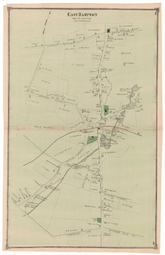
East Haddam
PublisherPublished by
F. W. Beers & Co.
(American)
Date1874
MediumLithography; black printer's ink and watercolor on wove paper
DimensionsPrimary Dimensions (image height x width): 14 1/4 x 22 1/2in. (36.2 x 57.2cm)
Sheet (height x width): 14 3/4 x 22 5/8in. (37.5 x 57.5cm)
Sheet (height x width): 14 3/4 x 22 5/8in. (37.5 x 57.5cm)
ClassificationsGraphics
Credit LineMuseum purchase
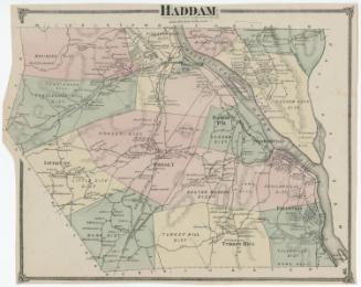
DescriptionMap of the town of East Haddam, Connecticut, with the town lines of Chatham and Colchester to the north, Salem to the east, Lyme to the south, and Haddam and the Connecticut River to the west. Haddam is divided into districts, marked with broken solid boundary lines. Roads are shown but not labeled. Buildings are depicted as solid black squares and are labeled with the name of the property owner or occupant. Natural features include elevation, conveyed through hachure marks, the Connecticut River and the Salmon River. To the left is an inset map of Hadlyme, located in the southern portion of East Haddam. Roads are shown but not labeled. Buildings are depicted as shaded squares and are labeled with the name of the property owner or occupant. A cemetery is colored green.
Object number1980.100.17
NotesCartographic Note: Scale, East Haddam: 1 inch equals 200 rods. Hadlyme: 1 inch equals 20 rods.On View
Not on view