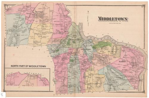
Middletown
PublisherPublished by
F. W. Beers & Co.
(American)
Date1874
MediumLithography; black printer's ink and watercolor on wove paper
DimensionsPrimary Dimensions (image height x width): 15 x 22 7/8in. (38.1 x 58.1cm)
Sheet (height x width): 15 3/8 x 23 1/4in. (39.1 x 59.1cm)
ClassificationsGraphics
Credit LineMuseum purchase
Object number1980.100.15
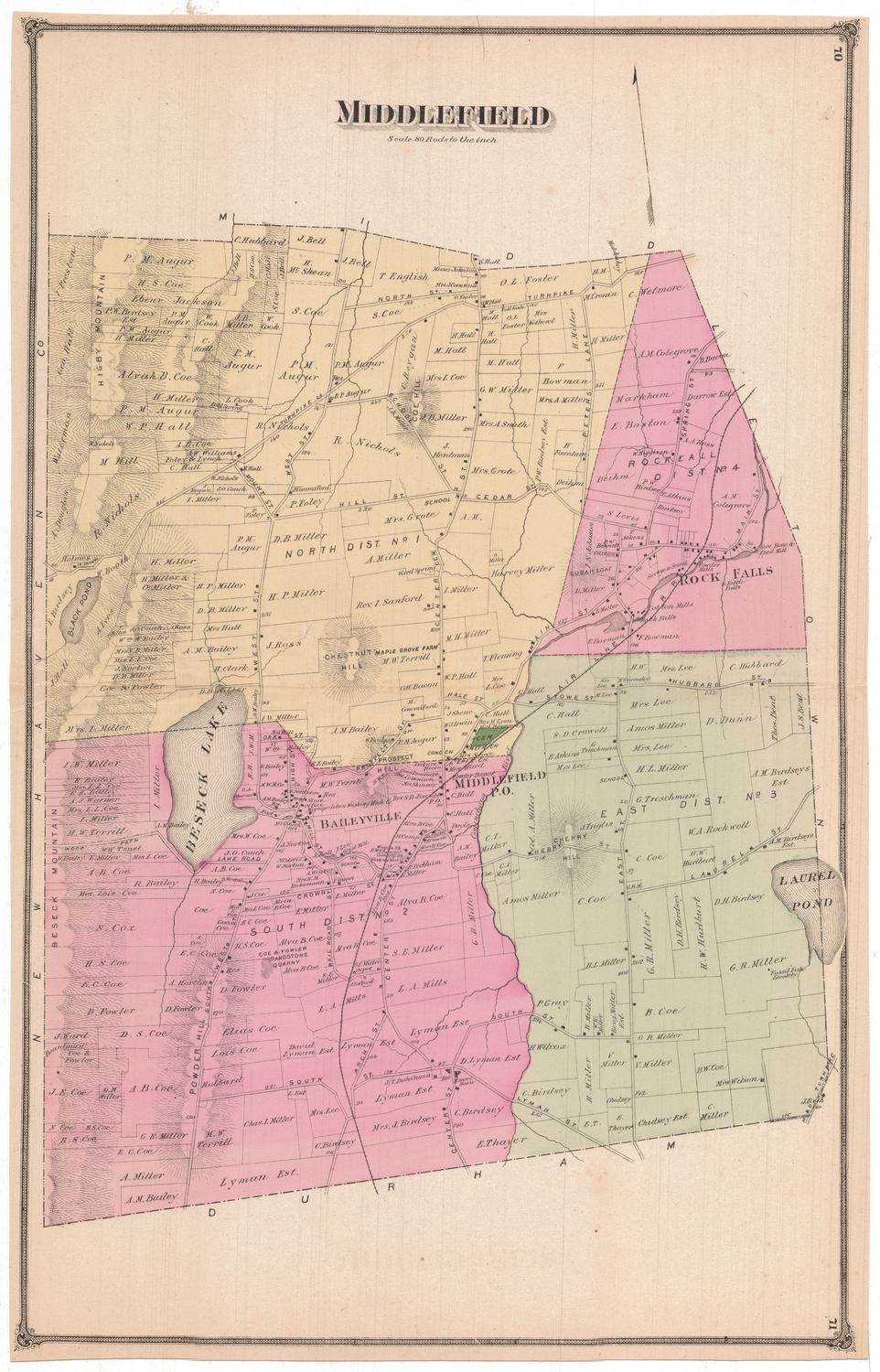
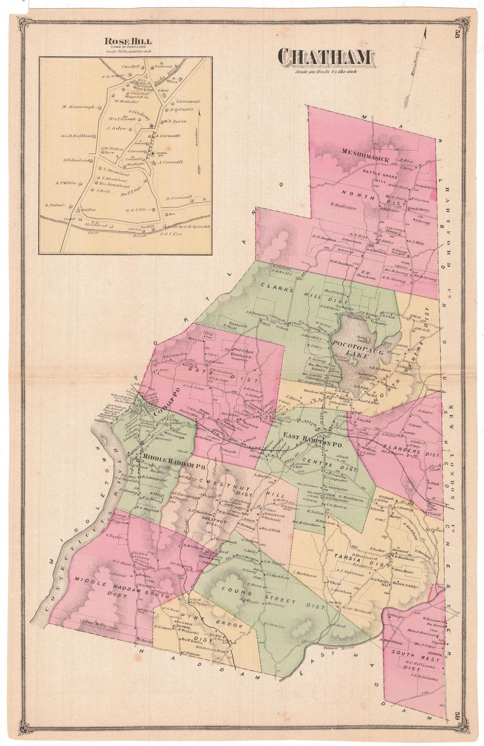
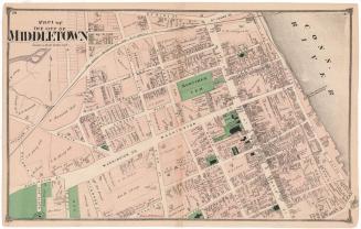
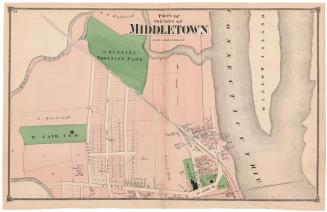
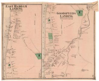
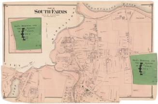
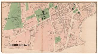
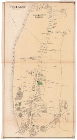
DescriptionMap of Middletown, Connecticut, with Hartford County, Cromwell and Portland to the north, the Connecticut River to the east, Durham and Haddam to the south, and New Haven county and Middlefield to the west. It is divided into districts with broken solid boundary lines between them, with the city of Middletown in the center. Buildings are depicted as solid black squares and are labeled with the name of the property owner or occupant. Cemeteries, orchards, Wesleyan University and "insane hospital land" are colored green. Elevation is conveyed with hachure marks, and the names of hills or mountains are provided. The Air Line and Connecticut Valley Railroads are depicted as well. In the bottom left corner is an inset map of the north part of Middletown, with the Sebethe River to the north.
Label TextThis map provides an overview of the town of Middletown, including the city of Middletown, which had been incorporated in 1784, and the outlying areas, some of them still extremely rural in character. Middlefield, which appears as a very obvious blank space at the lower left had been detached and incorporated as a separate town in 1866. This map was originally part of an atlas published in 1874 by F. W. Beers & Co. The atlas not only included a separate map of Middlefield, but also separate large scale maps of the densely built up sections of Middletown lying along the Connecticut River. Taken together, these maps provide a great deal of information about this bustling Connecticut community. The town and city of Middletown would once again be consolidated as single entity in 1923.
NotesCartographic Note: 1 inch equals 150 rodsStatus
Not on view