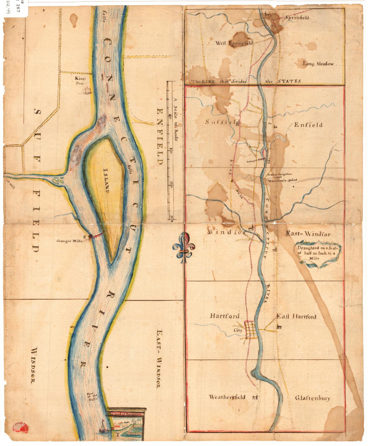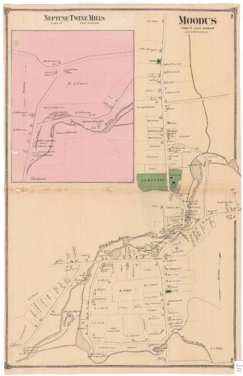
Moodus, Town of East Haddam
PublisherPublished by
F. W. Beers & Co.
(American)
Date1874
MediumLithography; black printer's ink and watercolor on wove paper
DimensionsPrimary Dimensions (image height x width): 22 3/8 x 14 5/8in. (56.8 x 37.1cm)
Sheet (height x width): 22 7/8 x 14 3/4in. (58.1 x 37.5cm)
ClassificationsGraphics
Credit LineMuseum purchase
Object number1980.100.3
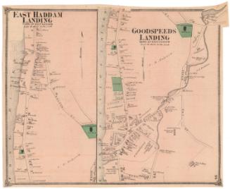
DescriptionMap of Moodus in the town of East Haddam, Connecticut, depicting the Moodus River and the various mills and companies along it, including the Moodus Manufacturing Company and twine, shingle, grist and saw mills. Roads are shown but not labeled, and lots of land are depicted with the owner or occupant's name and shaded rectangles representing buildings. A school, a cemetery, a Baptist church, Catholic church and a Methodist Episcopal church are shown in green. At the top left is an inset map of Neptune Twine Mills in East Haddam, along the Moodus River. The mill buildings are depicting, as are the buildings of a coffin trimming factory and a cotton factory.
Label TextThe community of Moodus is part of the town of East Haddam. Until about 1845, it was known as Mechanicsville, reflecting the amount of industry found along the Moodus River and its tributaries. Since communities named Mechanicsville also existed in Granby and Thompson, the name was changed to Moodus, derived from Machemoodus, the Mohegan name for the region. The name apparently means "there is a bad noise," and refers to seismic activity in the area. This map was originally part of an atlas published by F. W. Beers & Co.
NotesCartographic Note: Scale: 1 inch equals 20 rodsStatus
Not on view