The Century Atlas. New York, Southern Part
PrinterPrinted by the
Matthews-Northrup Company
(American)
PublisherPublished by
Century Company
(American, founded 1881)
Date1897
MediumLithography; black and colored printer's inks on wove paper
DimensionsPrimary Dimensions (image height x width): 15 x 10 1/2in. (38.1 x 26.7cm)
Sheet (height x width): 17 3/4 x 13 1/2in. (45.1 x 34.3cm)
Sheet (height x width): 17 3/4 x 13 1/2in. (45.1 x 34.3cm)
ClassificationsGraphics
Credit LineConnecticut Museum of Culture and History collection
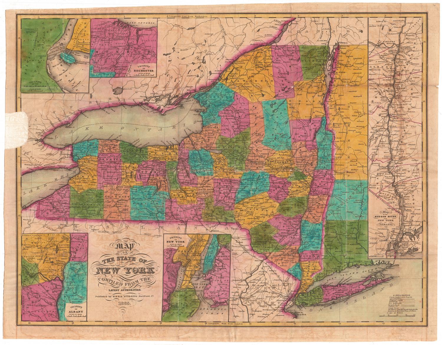
DescriptionTwo maps, one of southern New York State, from Kingston, New York, to the north, the boundary with Connecticut to the east, the Atlantic Ocean to the south, and Delaware, New York, to the west. There is an inset map of the Catskill Mountains in the top right corner of the image area. Below is a map of New York City and vicinity, with an inset map of the Hudson River Valley area. All of the maps use circles of varying sizes to indicate the population sizes of cities and towns. Red lines indicate railroads. Elevation is depicted with hachure marks.
Object number2012.312.215
NotesCartographic Note: Map of New York, Southern Part: 1 inch equals 16 miles. Map of Catskill Mountains: 1 inch equals 8 miles. Map of the Hudson: 1 inch equals 8 miles. Map of New York City: 1 inch equals 4 miles.On View
Not on view
Matthews-Northrup Company
1913