The Heart of the Connecticut
PublisherPublished by
The Bullard Company
(American, 1909 - 1915)
Date1913
MediumLithography; black and blue printer's inks on wove paper
DimensionsPrimary Dimensions (image height x width of .a): 42 1/8 x 31 1/8in. (107 x 79.1cm)
Sheet (height x width of .a): 45 1/8 x 34 5/8in. (114.6 x 87.9cm)
Primary Dimensions (image height x width of .b): 35 x 31 3/4in. (88.9 x 80.6cm)
Sheet (height x width of .b): 45 1/8 x 34 5/8in. (114.6 x 87.9cm)
ClassificationsGraphics
Credit LineConnecticut Museum of Culture and History collection
Object number2012.312.208
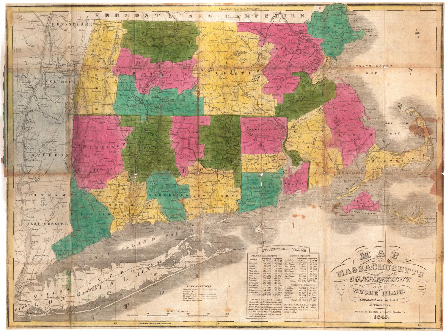
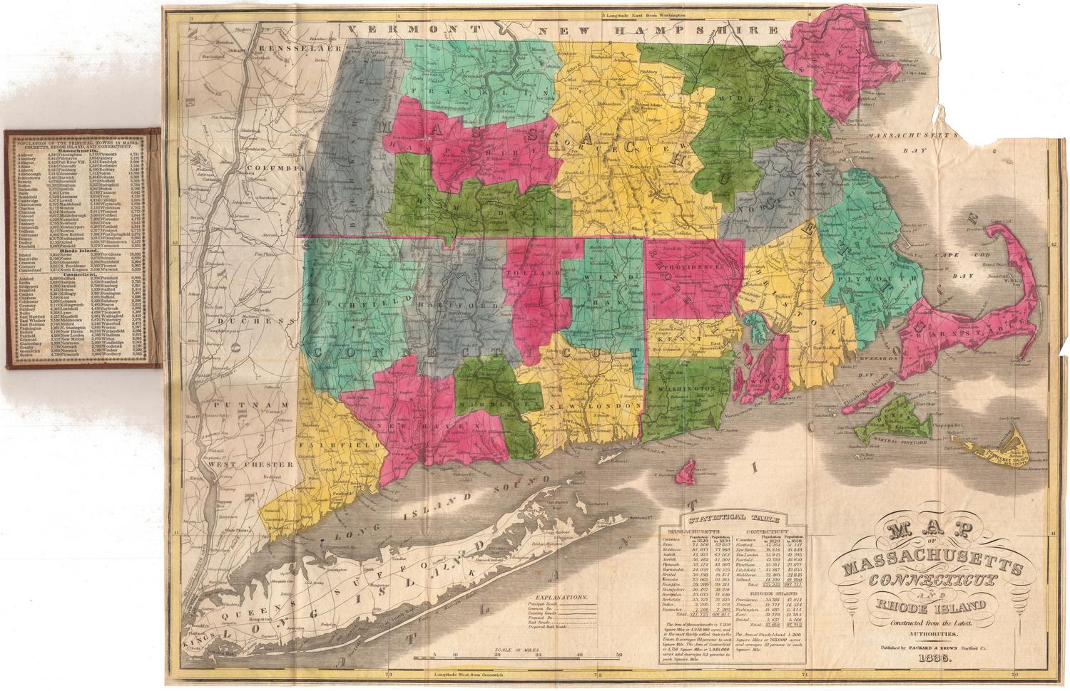
DescriptionMap of the Connecticut River Valley in Connecticut and Western Massachusetts, showing through and local roads, churches, schools, cemeteries, railroad stations, light houses and post offices. Altitude in feet is provided, and gradual and steep declines are marked with arrows. To the left of the map is a chart listing the distances between various places in Connecticut and Western Massachusetts. Below this are two population lists for towns in the counties depicted. On the verso is a map of most of New England, from the border of Canada and Bangor, Maine to the north, the Atlantic Ocean to the east, the Long Island Sound to the south, and the eastern part of New York State to the west. It shows roads and railroads. Above the map is an index to the towns and their populations, and in the bottom right corner is a table of distances by rail.
Label TextThis odd map places unusual emphasis on the electrical lines which were beginning to criss-cross Connecticut as new electrical companies were founded and electricity became more available. The reason for showing "good roads following electrical lines" is not clear. Although by 1913, street lights were becoming fairly common in Connecticut towns, highway lighting was still a thing of the future and most rural roads would have remained dark at night. The map's focus on only the western portions of Connecticut and Massachusetts is also odd. Perhaps eastern Connecticut and central Massachusetts were simply too sparsely populated and undeveloped to be of interest to the business travelers who presumably used this map--or perhaps those areas were included in a different map. The title of the map, "The Heart of the Connecticut," apparently refers to the Connecticut River Valley, though this is technically inaccurate, since the map includes areas well outside the Connecticut River watershed.
NotesCartographic Note: Scale (.a) 1 inch equals 3 miles; (.b) 1 inch equals 8 1/2 milesStatus
Not on view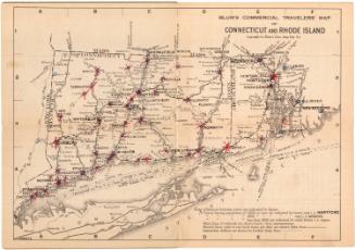
Blum's Commercial Map Publishing Company
1927-1928