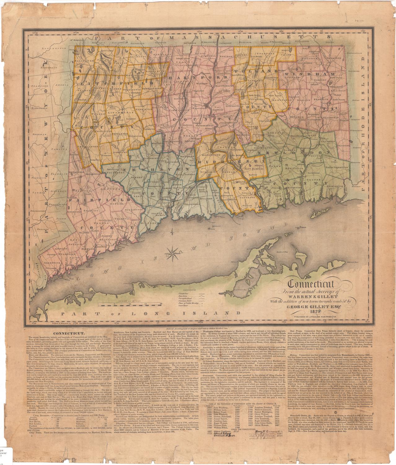
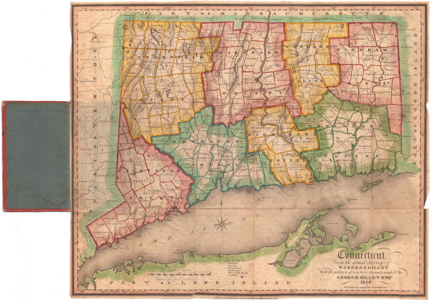
Connecticut, From Actual Survey
SurveyorSurveyed by
Moses Warren Jr.
(1762 - 1835)
SurveyorSurveyed by
George Gillet
(American, 1771 - 1853)
PrintmakerEngraved by
Abner Reed
(American, 1771 - 1866)
PublisherPublished by
Hudson & Goodwin
(American, founded 1787)
Date1813
MediumEngraving; black printer's ink and watercolor on paper, lined with paper
DimensionsPrimary Dimensions (image height x width): 36 1/8 x 43 1/8in. (91.8 x 109.5cm)
Sheet (height x width): 36 1/2 x 43 1/2in. (92.7 x 110.5cm)
Mount (height x width): 36 1/2 x 43 1/2in. (92.7 x 110.5cm)
ClassificationsGraphics
Credit LineConnecticut Museum of Culture and History collection
Object number2012.312.206
DescriptionMap of the state of Connecticut, with part of Massachusetts to the north, part of Rhode Island to the east, part of Long Island and the Long Island Sound to the south, and part of New York State to the west. Counties are outlined in broken solid and dotted lines and towns in solid lines. Elevation is depicted with hachure marks. Churches, courthouses, academies, town houses, factories and mills of various kinds, distilleries, glass works, furnaces, iron works, buoys, spindles and lighthouses are represented with symbols which are listed in the Explanation. Natural features shown include rocks off the coast, shoals, mountains and ore beds. Below the Explanation, located on the left side of the sheet, is a list of Connecticut governors from 1665-1813.
Label TextIn May 1811, the Connecticut legislature authorized the Hartford publishers Hudson & Goodwin to prepare and publish a new map of the state. Hudson & Goodwin hired two surveyors, Moses Warren and George Gillet to make this map. The two men used data from existing charts and maps as well as information from town clerks, but they also conducted a great deal of original survey work. The large-scale map that they produced was a model of accuracy and provded the basis for many subsequent maps of Connecticut. Gillet himself updated the map frequently over the course of the next twenty years. The original map may be the first to include the "Southwick jog," the small notch in Connecticut's northern border that was ceded to Massachusetts at the end of the eighteenth century to make up for earlier losses of territory.
NotesCartographic Note: Scale: About 3/8 inches equals 1 mileStatus
Not on view


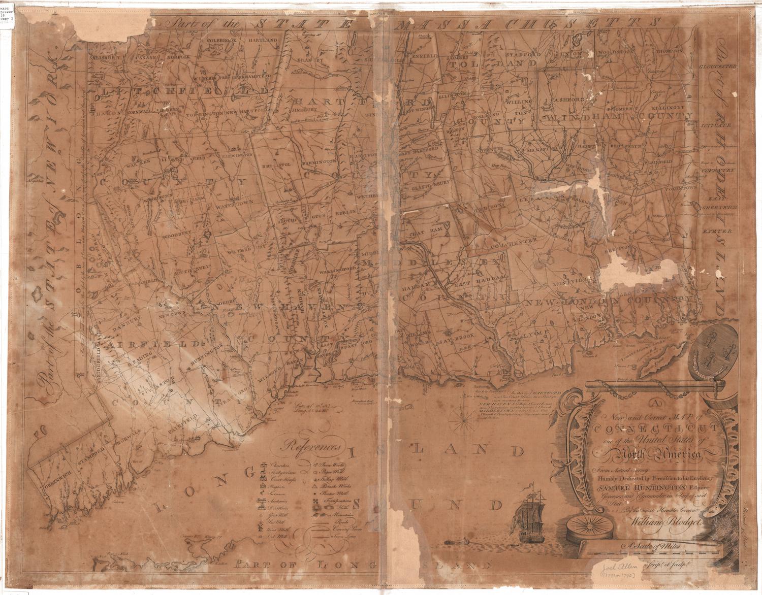
Joel Knott Allen
1791 or 1792
