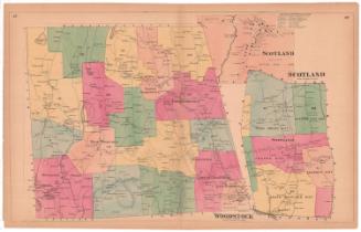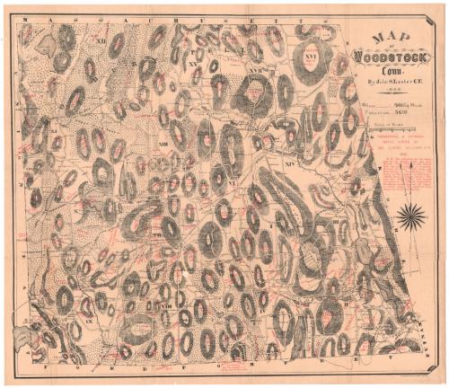
Map of Woodstock, Connecticut
SurveyorSurveyed by
John S. Lester
(American, 1835 - 1910)
MakerNames added by
George Clinton Williams
(American, 1853 - 1931)
PrinterPrinted by
Heliotype Printing Co.
(American, 1872 - 1908)
Date1883
MediumHeliotype; black and red printer's inks on wove paper, lined with linen
DimensionsPrimary Dimensions (image height x width): 24 x 27 7/8in. (61 x 70.8cm)
Sheet (height x width): 25 1/4 x 28 7/8in. (64.1 x 73.3cm)
Mount (height x width): 25 1/4 x 28 7/8in. (64.1 x 73.3cm)
ClassificationsGraphics
Credit LineConnecticut Museum of Culture and History collection
Object number2012.312.205
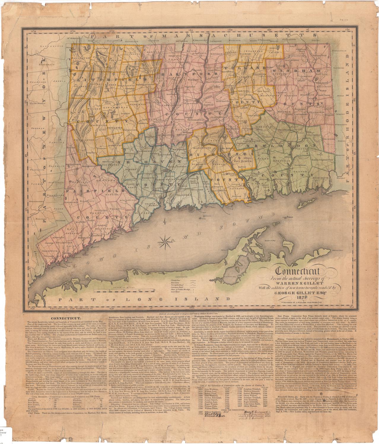
DescriptionMap of Woodstock, Connecticut, from the border of Massachusetts to the north, Putnam and Thompson to the east, Eastford and Pomfret to the south, and Union and Eastford to the west. The map primarily shows the local hills, conveyed with hachure marks and labeled in red. Also in red are historical names and dates related to buildings and landowners. The town is divided into seventeen sections, divided by broken solid lines. Roads are denoted with solid parallel lines and some of them are labeled. Buildings, probably mostly houses, are indicated with solid black squares and the owner's name if known.
Label TextJohn Lester drew this unusual map of Woodstock in 1883. The hills appear unusually prominent, emphasized by heavy black hachure marks. In 1886, George C. Williams, another town resident, added additional historical place names in red. The map includes a wealth of information, but is difficult to read, due to its peculair format. Folded copies were included in C. W. Bowen's History of Woodstock, slipped into a pocket inside the cover. Not surprisingly, these copies often became separated from the book, and frequently show up independently.
NotesCartographic Note: 3 inches equals 1 mileStatus
Not on view