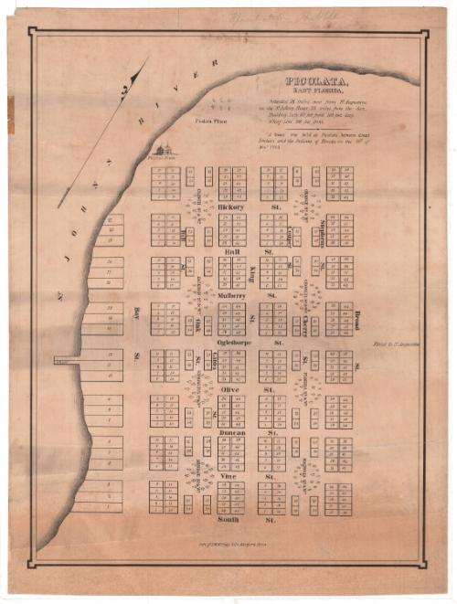
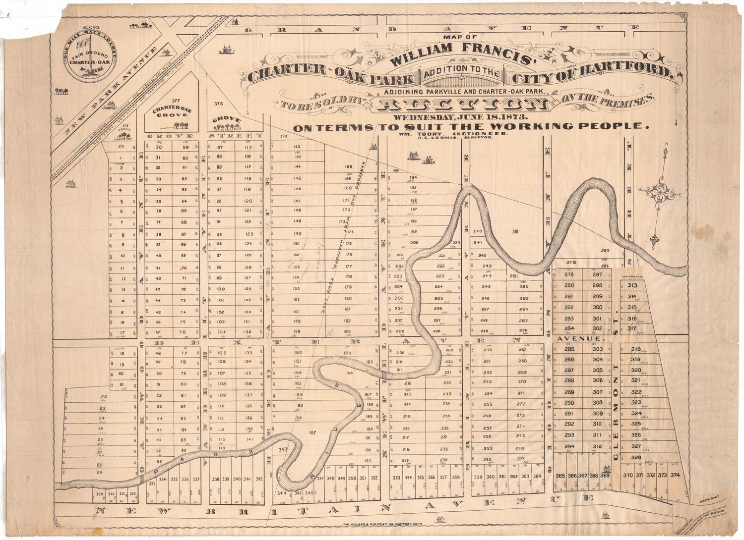
Picolata, East Florida
PrinterPrinted by
D. W. Kellogg & Co.
(American, 1830 - 1840)
DateProbably 1830-1835
MediumLithography; printer's ink on wove paper
DimensionsPrimary Dimensions (image height x width): 17 1/4 x 12 3/4in. (43.8 x 32.4cm)
Sheet (height x width): 18 5/8 x 14in. (47.3 x 35.6cm)
ClassificationsGraphics
Credit LineConnecticut Museum of Culture and History collection
Object number1991.188.0
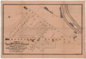
DescriptionMap of building lots in Picolata, Florida, on the east side of the St. Johns River, pictured on the map. The lots are grouped in clusters of 48, situated around named squares and woods. Running north-south are Bay Street, Oak Street, King Street, Cherry Street, Stephens Street and Broad Street; running east-west are Hickory, Hall, Mulberry, Oglethorpe, Olive, Duncan, Vine and South Streets. At the top of the map is a depiction of a two story building with smoke coming out of its twin chimneys; it is labeled "Picolata House." Above it and to the right is a stand of six trees, named "Picolata Place." West of Bay Street, the closest road to the river, are 21 wharf lots. Numbers 11 and 12 extend into the river, and are labeled, "Wharf."
Label TextThis map showing Picolata, Florida as a tidy small town laid out on a grid plan interspersed with small squares planted with trees is something of a mystery. A scrawled notation on the top of the map provides a clue as to its probable purpose: "Speculation Bubble." It seems likely that any attempt to lure prospective settlers to some real estate developer's dream of a southern settlement ended with the outbreak of the Second Seminole War in 1835. During the war, Picolata served as an important military outpost. An 1837 lithograph shows the town as a cluster of frame buildings and tents.
NotesCartographic Note: No scaleSubject Note: The Picolata House, which appears at the top of the map, was a hotel owned and operated by John P. Levy. In an announcement published in the Jacksonville Courier in 1835, Levy revealed that the hotel, which apparently had been in existence prior to the announcement, was "greatly enlarged, will comfortably accommodate a numerous company, the Rooms will be well furnished and the Table richly supplied with the best fare the country affords."
Jacksonville Courier, November 19, 1835.
Status
Not on view

Silvermine Production
1973