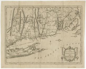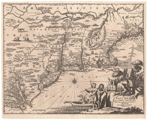
Novi Belgii, quod nunc Novi Jorck
PublisherPublished by
Arnoldus Montanus
(Dutch, 1625 - 1683)
Date1671
MediumEngraving; printer's ink on laid paper
DimensionsPrimary Dimensions (image height x width): 11 3/8 x 14 3/8in. (28.9 x 36.5cm)
Platemark (height x width): 11 1/2 x 14 1/2in. (29.2 x 36.8cm)
Sheet (height x width): 12 1/8 x 14 3/4in. (30.8 x 37.5cm)
Platemark (height x width): 11 1/2 x 14 1/2in. (29.2 x 36.8cm)
Sheet (height x width): 12 1/8 x 14 3/4in. (30.8 x 37.5cm)
ClassificationsGraphics
Credit LineThe Newman S. Hungerford Museum Fund
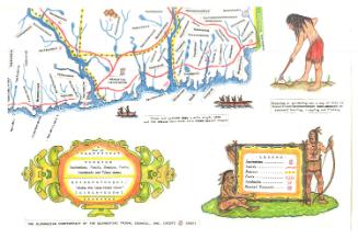
DescriptionMap of the east coast of the United States, from Chesapeake Bay to Quebec, with the St. Lawrence River to the north, the mythical Norumbega to the east, the Atlantic Ocean to the south, and the Delmarva Peninsula and points north to the west. The names of Native American tribes and their locations are prominent on the map. Forts and settlements are marked with symbols and names. Geographic features include elevation, conveyed through depictions of shaded mountains; forests, denoted as clusters of trees; rivers, islands, bays and sandbars. Bears, deer, turkeys, beavers and rabbits appear scattered across the land. The title cartouche shows Native American scenes, featuring a wigwam settlement, hunting, exploration in a canoe, and two standing figures, one with a bow and the other holding a chisel-type tool against a large rectangular block. A compass rose with a north arrow appears in the part of the Atlantic Ocean south of Long Island.
Object number2012.172.2
NotesCartographic Note: The scale shows measurements in increments of 5, from 0-15, and is accompanied by the phrase "Milliaria Germanica communia"On View
Not on view

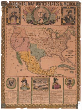
H. F. Sumner & Co.
1833