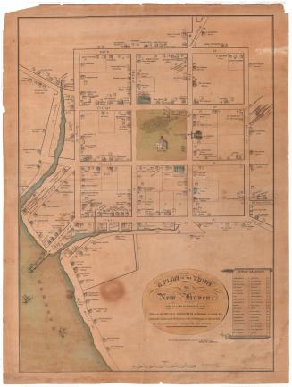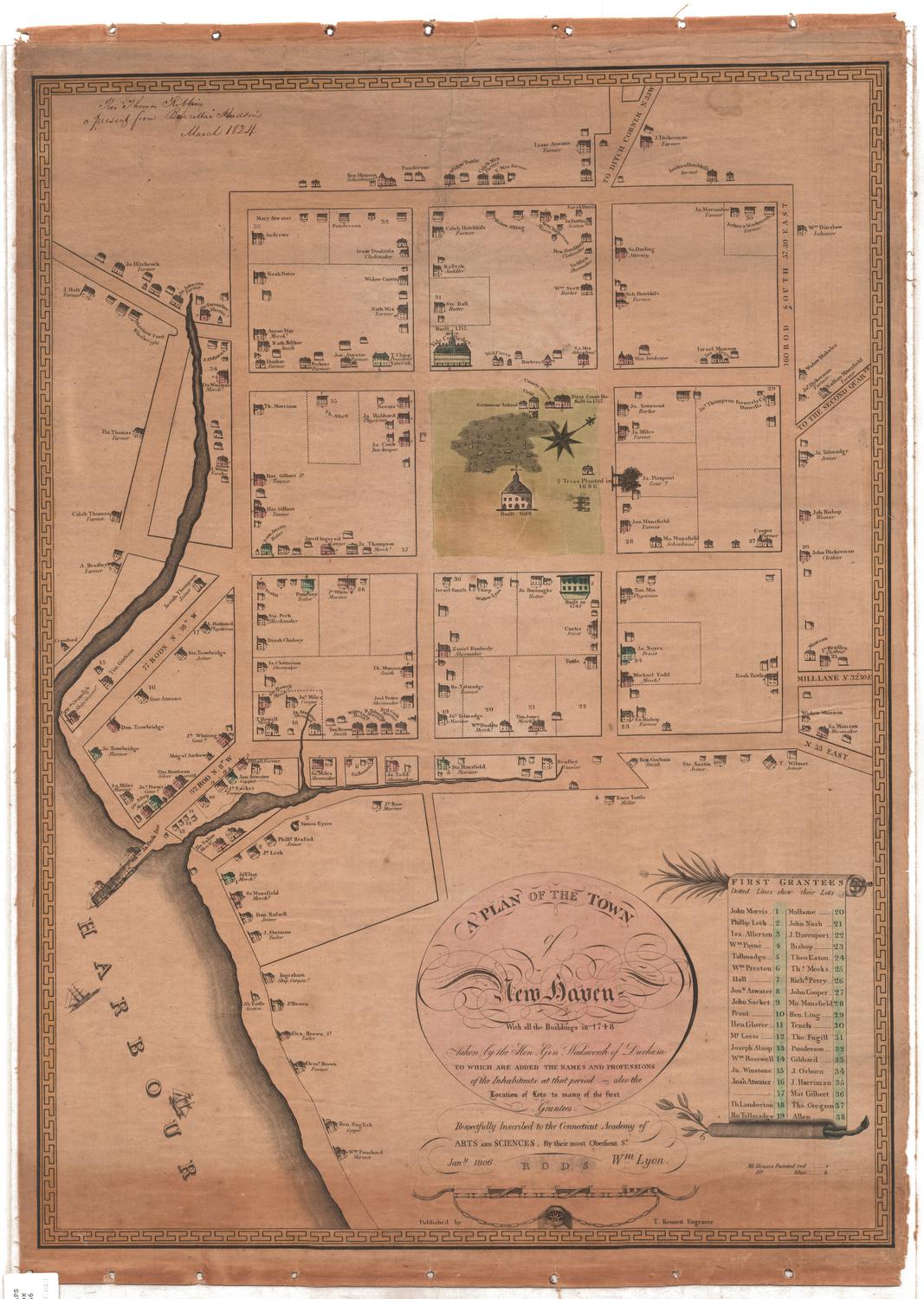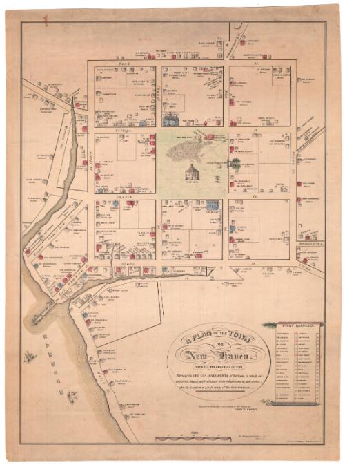
A Plan of the Town of New Haven with all the buildings in 1748
PrinterPrinted by
Charles Currier
(American, 1818 - 1887)
After a work byAfter a work by
James Wadsworth
(American, 1730 - 1817)
Dateabout 1865
MediumLithography; black printer's ink, watercolor and other color on wove paper
DimensionsPrimary Dimensions (image height x width): 21 1/2 x 15 5/8in. (54.6 x 39.7cm)
Sheet (height x width): 23 x 17 1/8in. (58.4 x 43.5cm)
ClassificationsGraphics
Credit LineMuseum purchase
Object number1951.34.0
DescriptionThe town of New Haven, Connecticut, with depictions of houses accompanied by the names and professions of their owners or occupants in 1748. The map is oriented with the north arrow pointing toward the top right corner, and it extends from York Street at the top, Grove Street to the right, Water Street at the bottom and Morocco Street to the west. In the center of the map is the town green, which contains the grammar school, county house, court house,an unnamed building, an unnamed church and a building labeled as the "goal," which may be a misspelling of "gaol." There is also a cemetery, three canons, and "2 Trees Planted in 1686." Yale College appears at the top of the green. On the right side is a list of the first grantees, depicted as written on a scroll; at the top of the scroll is what appears to be a fir tree branch, and at the bottom is an olive branch.
Label TextThe architect David R. Brown issued this reprint of the important early map of New Haven that had been drawn by James Wadsworth in 1748 and printed by Thomas Kensett in 1806. Brown's version of the map is slightly reduced in scale and somewhat simpler than the earlier original; the elaborate border of the 1806 map has been replaced by a single rule, and the flowing script has been replaced by simple block lettering. Brown was a skilled draftsman and may have redrawn this later version himself shortly after he returned home to New Haven from the Civil War. While the original map was dedicated to The Connecticut Academy of Arts and Sciences, Brown dedicated his version to the citizens of New Haven, suggesting that it was intended primarily for a local audience. The Connecticut Historical Society has two copies of this later version of the map with very different hand-coloring. While color printing was becoming common by the 1860s, many lithographs were still colored by hand using watercolors.
NotesCartographical Note: Scale: About 3 3/4 inches equals 60 rodsConstituent Note: The Charles Currier who printed this lithograph was the brother of Nathaniel Currier, one of the partners in the lithographic firm, Currier & Ives. James Merritt Ives, the other partner, was Currier's brother-in-law. Charles Currier was sometimes associated with his brother's firm and sometimes issued prints on his own.
Status
Not on view