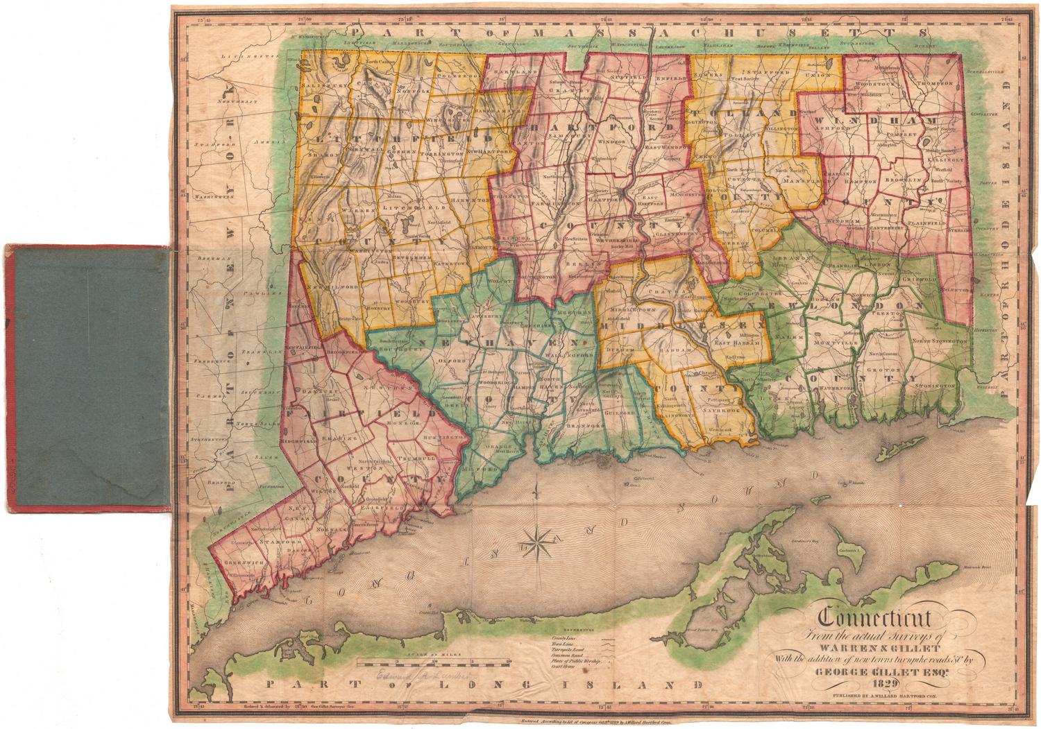
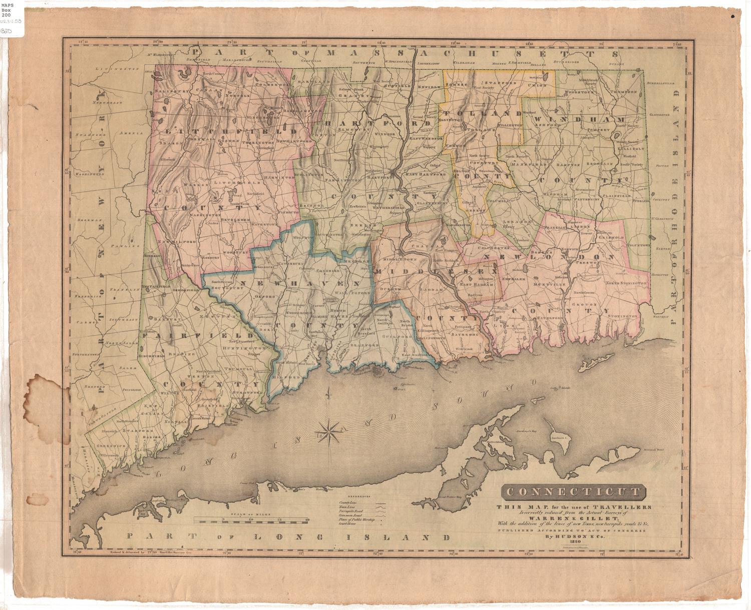
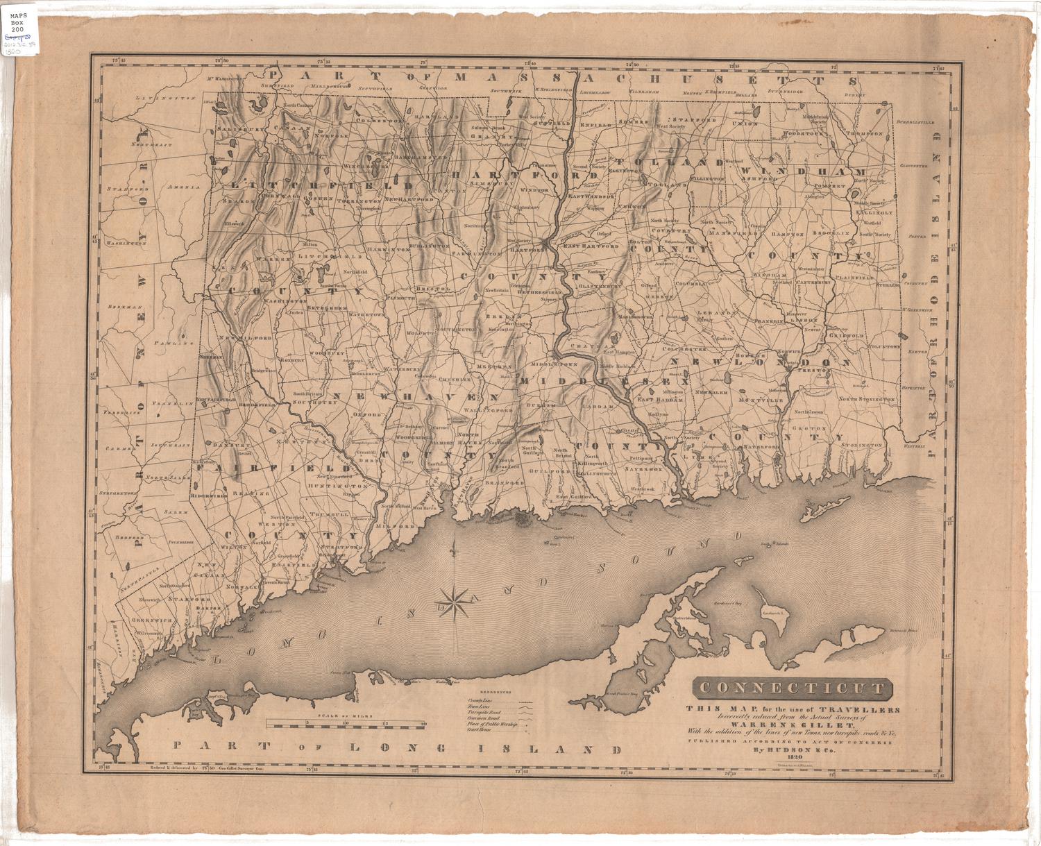
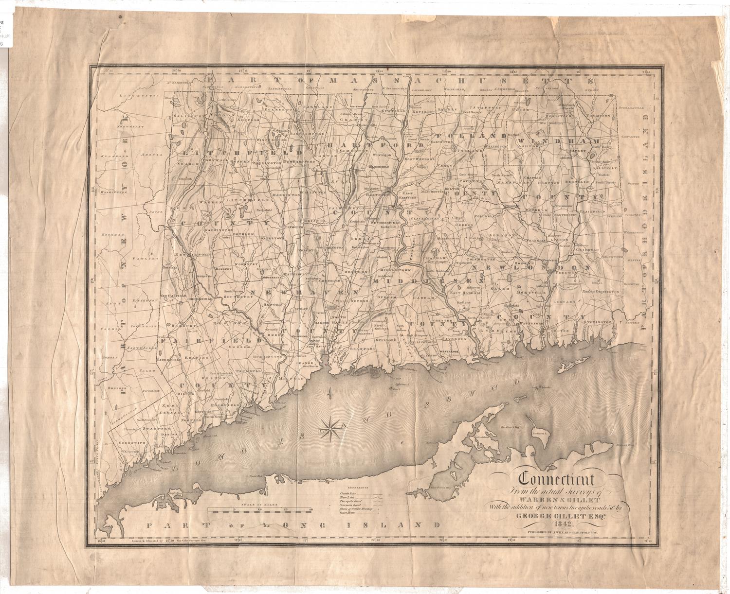
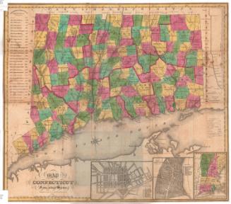
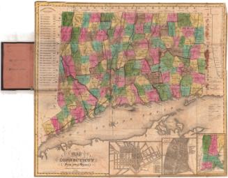
Connecticut from the actual Surveys of Warren & Gillet, with the addition of new towns, turnpike roads &c
SurveyorSurveyed by
Moses Warren Jr.
(1762 - 1835)
SurveyorSurveyed by
George Gillet
(American, 1771 - 1853)
MakerRevised by
George Gillet
(American, 1771 - 1853)
PublisherPublished by
Asaph Willard
(1786 - 1880)
DraftsmanDrawn by
George Gillet
(American, 1771 - 1853)
Date1833
MediumEngraving; black printer's ink and watercolors on paper, lined with linen
DimensionsPrimary Dimensions (image height x width): 17 3/4 x 21 1/4in. (45.1 x 54cm)
Sheet (height x width): 26 3/4 x 24 1/4in. (67.9 x 61.6cm)
Mount (height x width): 26 3/4 x 24 1/4in. (67.9 x 61.6cm)
Sheet (height x width): 26 3/4 x 24 1/4in. (67.9 x 61.6cm)
Mount (height x width): 26 3/4 x 24 1/4in. (67.9 x 61.6cm)
ClassificationsGraphics
Credit LineMuseum purchase
DescriptionMap of Connecticut, with the border of Massachusetts to the north, Rhode Island to the east, Long Island and the Long Island Sound to the south, and New York to the west. The state is divided into counties and towns, with turnpike roads, common roads, courthouses and churches included on the map. Elevation is conveyed through hachure marks. Below the map is text about Connecticut's natural features, history, towns and colleges and universities, as well as a population table.
Object number1930.10.0
NotesCartographic Note: Scale: 3 3/4 inches equals 20 milesOn View
Not on view