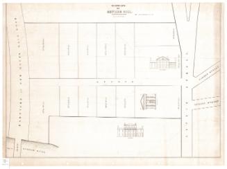
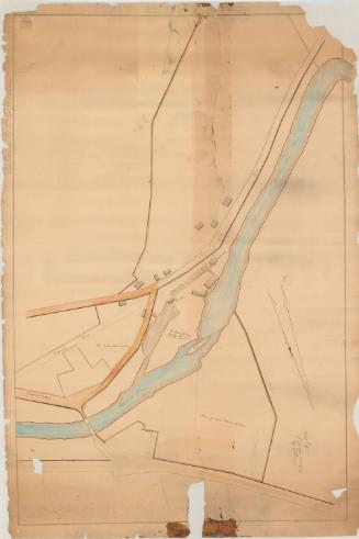
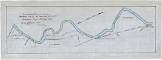
Plan of Company's Land
MakerMade by
Unknown
Datebefore 1800
MediumDrawing; black ink on laid paper
DimensionsPrimary Dimensions (image height x width): 19 1/2 x 28 1/2in. (49.5 x 72.4cm)
Sheet (height x width): 19 1/2 x 28 1/2in. (49.5 x 72.4cm)
Sheet (height x width): 19 1/2 x 28 1/2in. (49.5 x 72.4cm)
ClassificationsGraphics
Credit LineMuseum purchase
DescriptionMap of an unknown company's land, possibly in Suffield, Connecticut near the Mill River and Great River (an old name for the Connecticut River). On the right side of the Mill River, on both sides of a highway, plots of land are delineated. One of the lots and a wharf abut the Great River in the bottom right corner. On the left side of the Mill River, there is a large plot of land and above it, a highway and what appear to be several buildings. One of the squares is labeled with the owner's name.
Object number1985.207.0
NotesCartographic Note: No scaleOn View
Not on view
Erastus Worthington
1907
Silvermine Production
1973