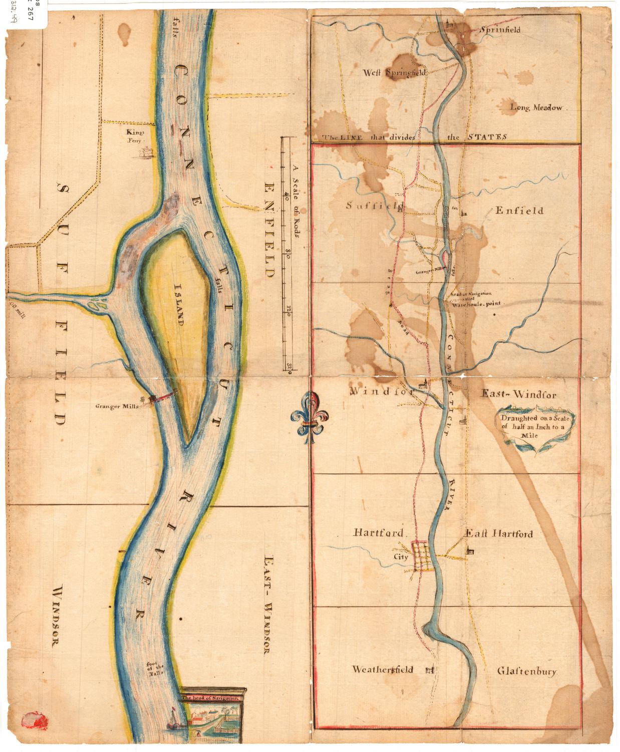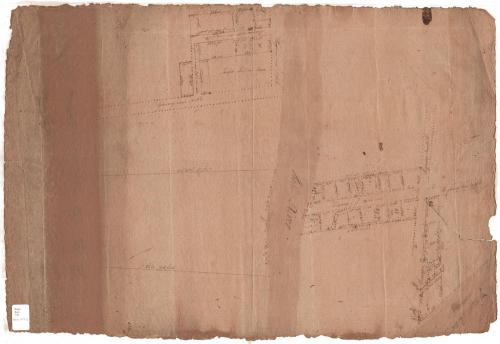
Plan of Company's Land
MakerMade by
Unknown
Datebefore 1800
MediumDrawing; black ink on laid paper
DimensionsPrimary Dimensions (image height x width): 19 1/2 x 28 1/2in. (49.5 x 72.4cm)
Sheet (height x width): 19 1/2 x 28 1/2in. (49.5 x 72.4cm)
ClassificationsGraphics
Credit LineMuseum purchase
Object number1985.207.0
DescriptionMap of an unknown company's land, possibly in Suffield, Connecticut near the Mill River and Great River (an old name for the Connecticut River). On the right side of the Mill River, on both sides of a highway, plots of land are delineated. One of the lots and a wharf abut the Great River in the bottom right corner. On the left side of the Mill River, there is a large plot of land and above it, a highway and what appear to be several buildings. One of the squares is labeled with the owner's name.
Label TextThe name "Joseph Sheldon" which appears on this map may be a clue to the area that it depicts. The first Joseph Seldon settled in Suffield, Connecticut in 1689; he had a son named Joseph Seldon who may be the Joseph Seldon to whom the inscription refers. The Great River was an early name for the Connecticut River, and the Mill River was an early name for Stony Brook, which flows into the Connecticut River in Suffield. However, there were other Seldons living upstream in Massachusetts, and it is possible that this map represents a site in that state.
NotesCartographic Note: No scaleStatus
Not on view
Erastus Worthington
1907


Silvermine Production
1973