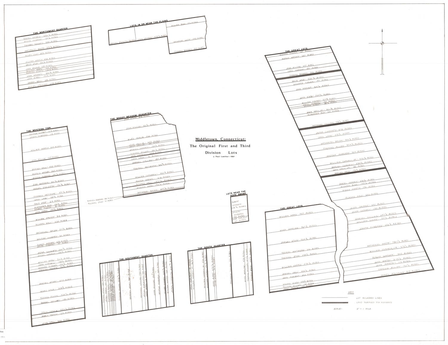
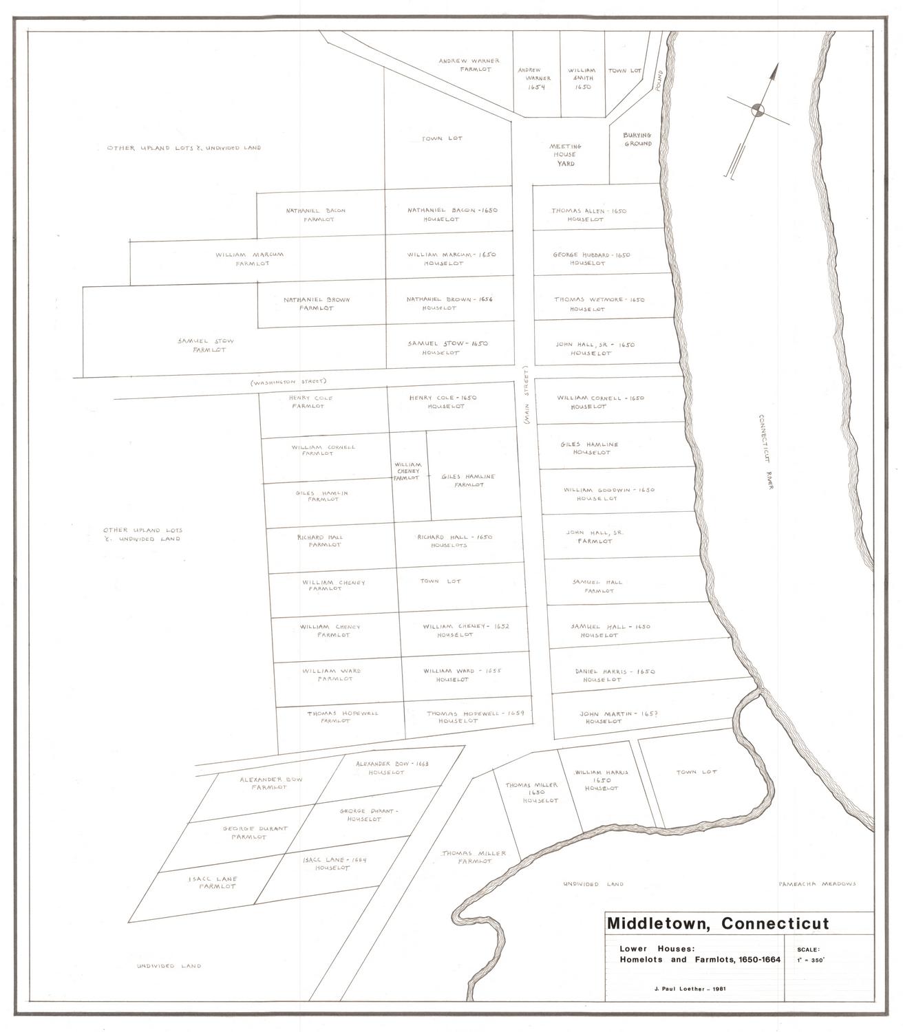
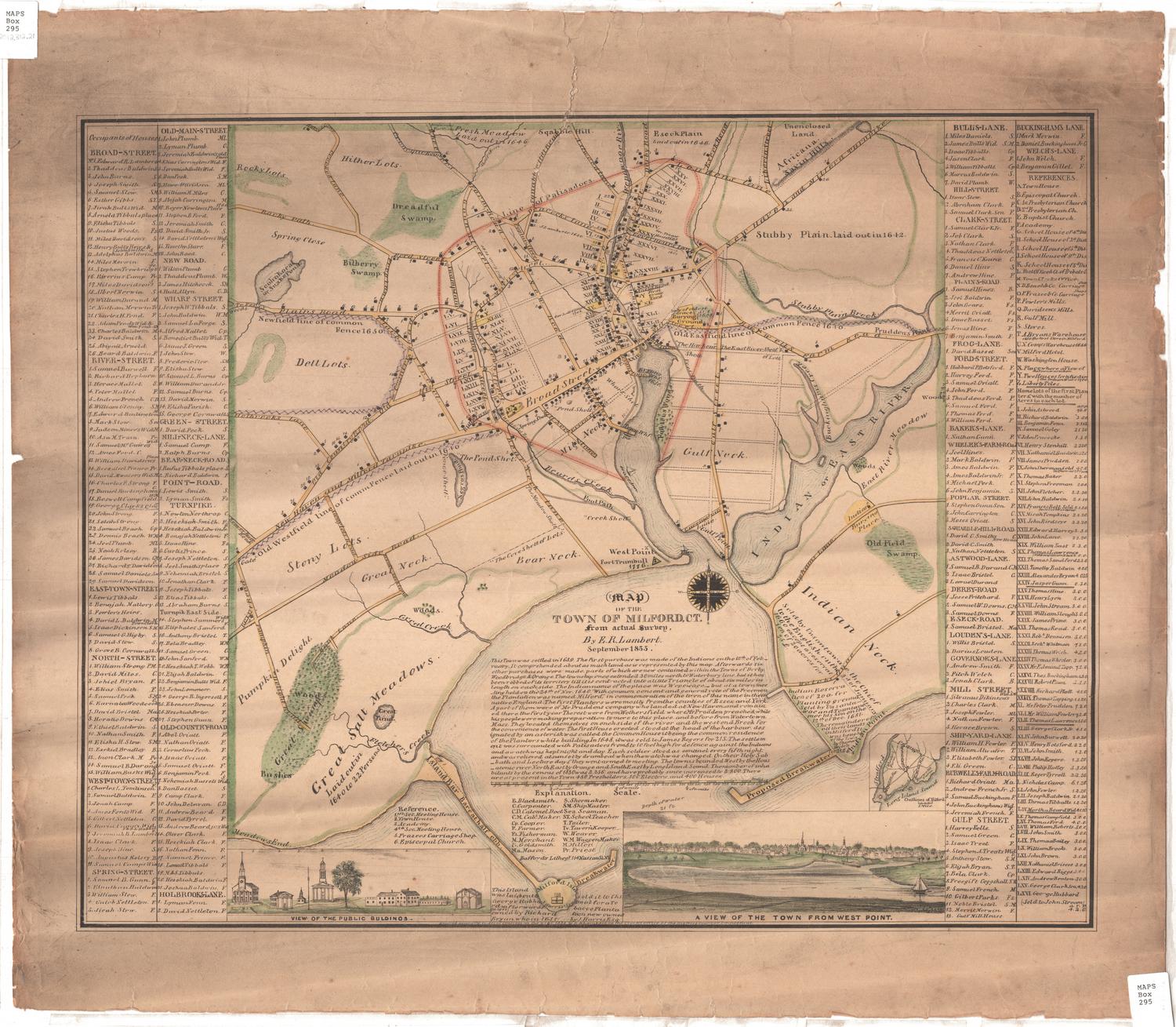
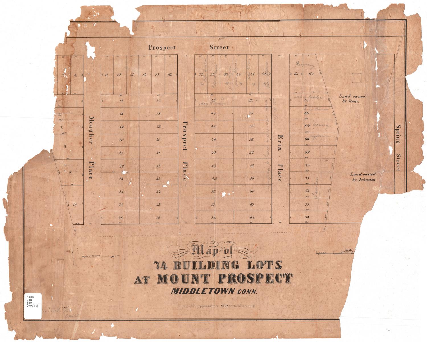
Middletown, Connecticut: Original First and Third Division Lots
DraftsmanDrawn by
J. Paul Loether
(American, born 1953)
Date1981
MediumDrawing; pencil and dry transfer letters on paper
DimensionsPrimary Dimensions (image height x width): 25 1/8 x 32 3/8in. (63.8 x 82.2cm)
Sheet (height x width): 26 5/8 x 34 3/8in. (67.6 x 87.3cm)
Sheet (height x width): 26 5/8 x 34 3/8in. (67.6 x 87.3cm)
ClassificationsGraphics
Credit LineGift of J. Paul Loether
DescriptionMap of parts of what was Middletown, Connecticut, in the late-seventeeth to early-eighteenth centuries, showing the Northwest Quarter, lots in or near the plains, the Great Lots, the Western Tier, the Boggy Meadow, the Southwest Quarter, the South Quarter, and the lots near the Hope Swamp. The map is designed to show the placement of these areas in the absence of the North Commons, the Plain Lots, the Nooks Divisions, the South Commons, an unnamed area that contains lots, a meadow, and "Indian land," the upland lots southeast of town, and half mile lots, all of which were also part of Middletown during that time period. The divisions that are shown contain lots with the owner's name and their size in acres. At the bottom right is the map key.
Object number1986.299.4
NotesCartographic Note: Scale: 2 inches equals 1 mileOn View
Not on view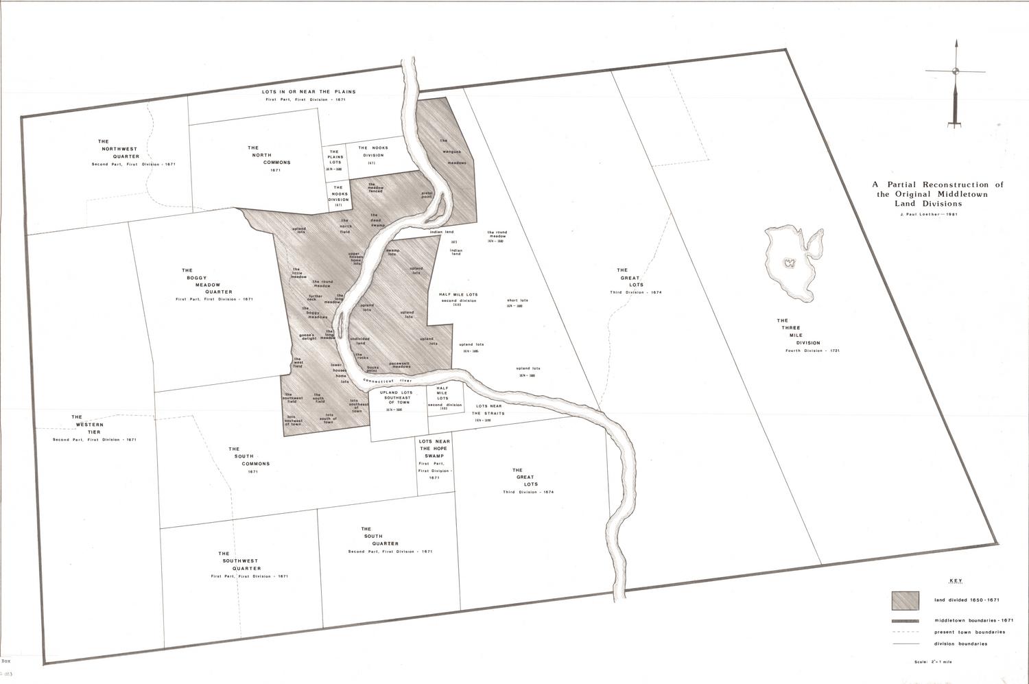
Silvermine Production
1973