
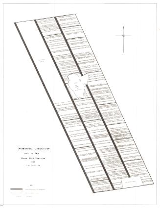
A Partial Reconstruction of the Original Middletown Land Divisions
DraftsmanDrawn by
J. Paul Loether
(American, born 1953)
Date1981
MediumDrawing; pencil and dry transfer letters on paper
DimensionsPrimary Dimensions (image height x width): 23 1/8 x 34 1/2in. (58.7 x 87.6cm)
Sheet (height x width): 23 3/4 x 35 1/4in. (60.3 x 89.5cm)
Sheet (height x width): 23 3/4 x 35 1/4in. (60.3 x 89.5cm)
ClassificationsGraphics
Credit LineGift of J. Paul Loether
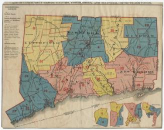
DescriptionMap of the original territory of Middletown, Connecticut, from the northwest quarter and lots in or near the plans to the north, the Three Mile Division to the east, the southwest and south quarters to the south, and the western tier to the west. The Connecticut River runs through the center. The various divisions are labeled with names and dates, and the division in the center contains the names of further subdivisions. It is also shaded in, which, according to the Key located in the bottom right corner, means that the land was divided between 1650-1671. As well as detailing the old boundary lines of Middletown in 1671 and the division boundaries, the map shows the present town lines.
Object number1986.299.3
NotesCartographic Note: Scale: 1 inch equals 1/2 mileOn View
Not on view

Kellogg & Bulkeley
1915-1920

Kellogg & Bulkeley
1910-1915