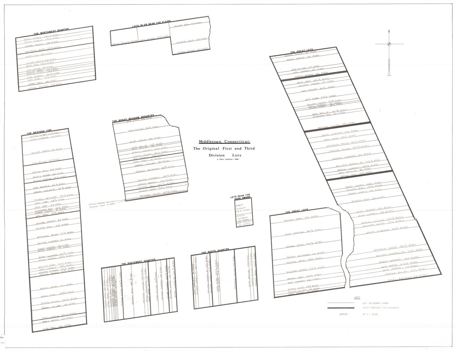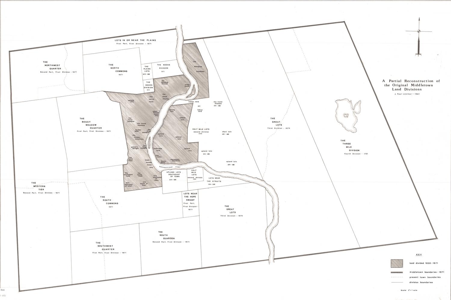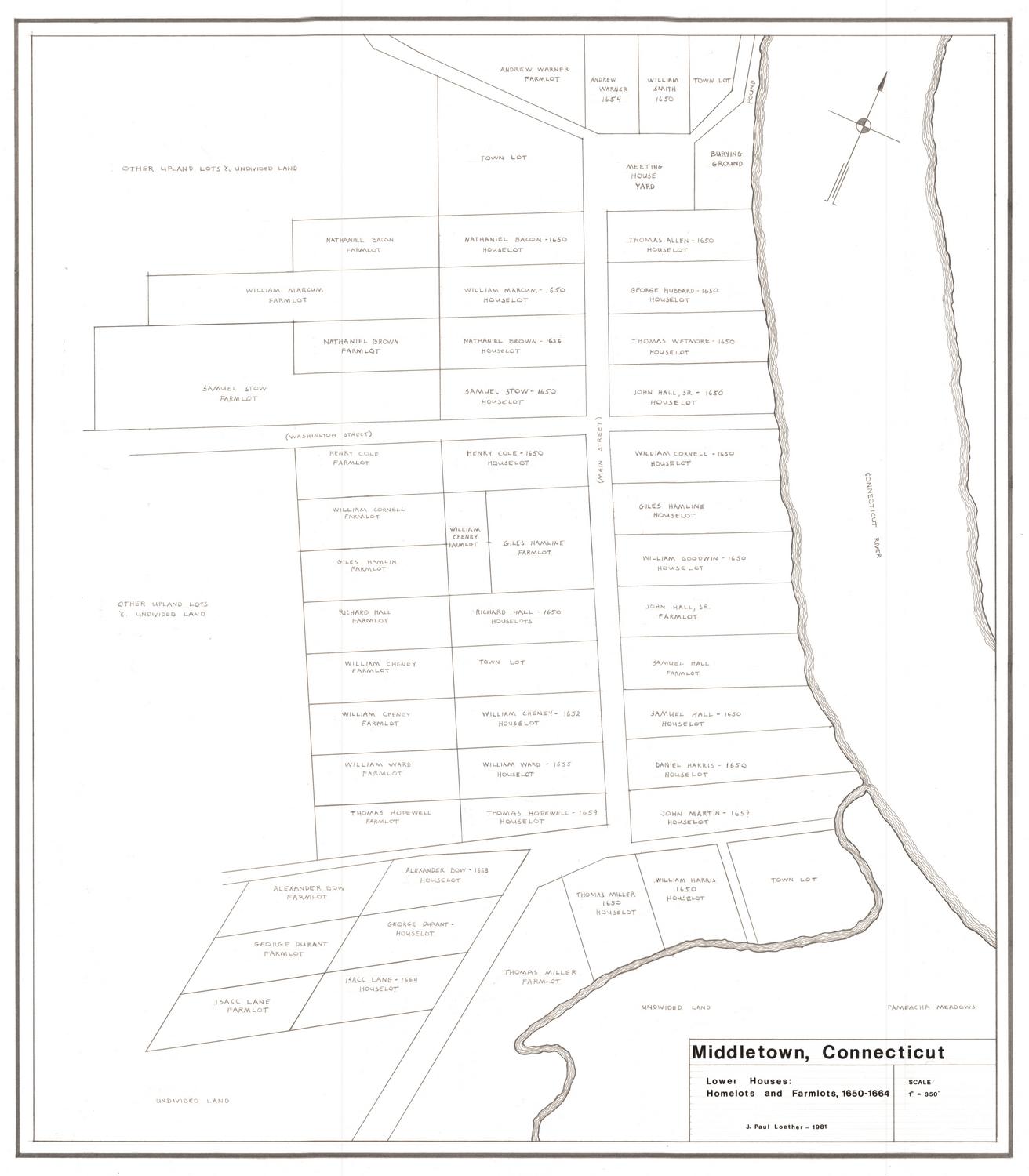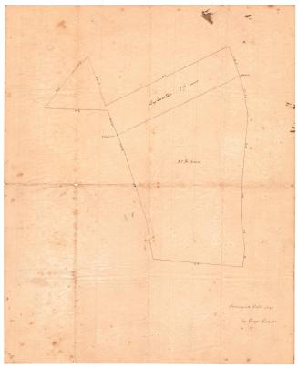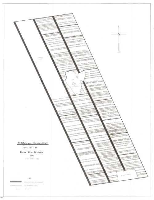
Middletown, Connecticut: Lots in the Three Mile Division, 1721
DraftsmanDrawn by
J. Paul Loether
(American, born 1953)
Date1981
MediumDrawing; pencil and dry transfer on paper
DimensionsPrimary Dimensions (image height x width): 25 5/8 x 19 3/4in. (65.1 x 50.2cm)
Sheet (height x width): 27 7/8 x 21 5/8in. (70.8 x 54.9cm)
ClassificationsGraphics
Credit LineGift of J. Paul Loether
Object number1986.299.2
DescriptionMap of part of what was Middletown, Connecticut, in 1721, showing lots of land on along local highways, with Lake Pocotapaug in the middle, and Mr. Hart's farm at the bottom bridging both sides of the highway. Each lot is labeled with the property owner's name and size in acres. At the bottom left is the key.
Label TextThe Three Mile Division of Middletown was located on the east side of the Connecticut River and was settled about 1710. This area was incorporated as the town of Chatham in 1767. In 1841, the town of Portland separated from Chatham, and the remainder of Chatham changed its name to East Hampton in 1915. J. Paul Loether was working on his master's degree in architecture at Wesleyan University when he created this map for the Greater Middletown Preservation Trust.
NotesCartographic Note: Scale: 1 inch equals 2000 feetStatus
Not on view