
The Map of the Connecticut Company System and Connections
Date1915-1929
MediumLithography; black and red printer's inks on wove paper
DimensionsPrimary Dimensions (image height x width): 15 7/8 x 22 3/8in. (40.3 x 56.8cm)
Sheet (height x width): 17 3/4 x 24in. (45.1 x 61cm)
Sheet (height x width): 17 3/4 x 24in. (45.1 x 61cm)
ClassificationsGraphics
Credit LineConnecticut Museum of Culture and History collection
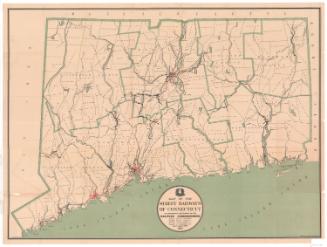
DescriptionMap of Connecticut showing the Connecticut Company's system of street railways and other electric lines, including those of the Stamford Division, that ran into New York. Steam railroad lines, steamboat lines, parks, benches and resorts are also included on the map. To the left of the map is a legend that explains the different lines and symbols. On the back cover, there is a map of the Connecticut Company's "Trolley Express" service.
Object number2012.312.197
NotesCartographic Note: Scale: 1 inch equals 5 milesOn View
Not on view
Matthews-Northrup Company
1913
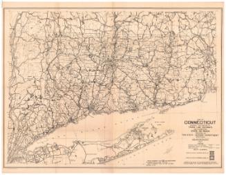
Connecticut State Highway Department
1927
