Glastonbury Conn.
MakerPrepared by
Robert O. Rider
(American, 1892 - 1956)
MakerPrepared by
Herbert T. Clark
(American, 1878 - 1972)
MakerPrepared by
John T. Henderson
(American, 1876 - 1962)
PublisherPublished by
Glastonbury Tercentenary Committee
(American, founded 1935)
Date1935
MediumLithography; black and green printer's inks on wove paper
DimensionsPrimary Dimensions (image height x width): 15 1/2 x 21in. (39.4 x 53.3cm)
Sheet (height x width): 17 x 22 1/2in. (43.2 x 57.2cm)
ClassificationsGraphics
Credit LineConnecticut Museum of Culture and History collection
Object number2012.312.195
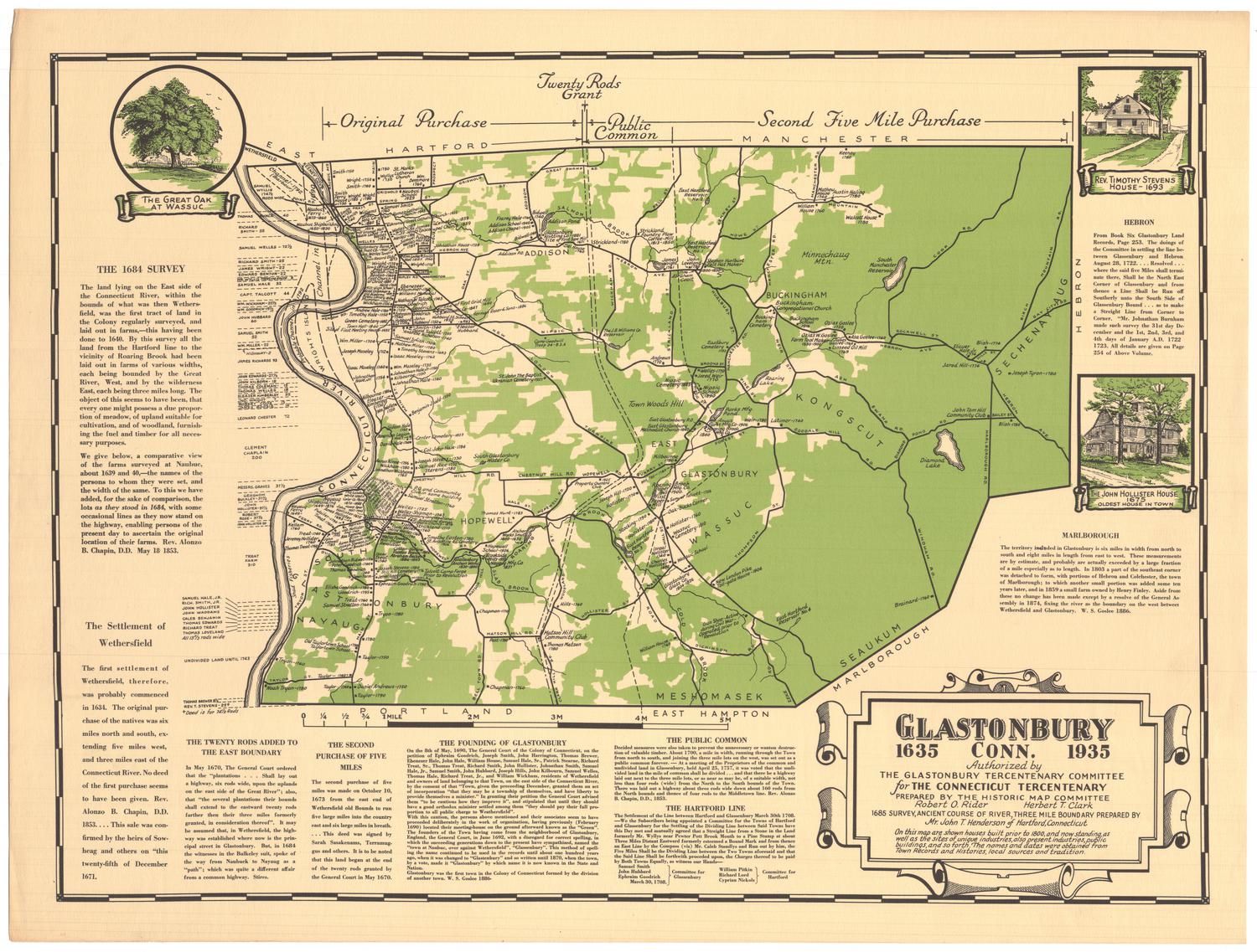
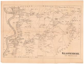
DescriptionMap of Glastonbury, Connecticut, extending from the borders of Hartford and Manchester to the north, Hebron and Marlborough to the east, Portland and East Hampton to the south, and the Connecticut River to the west. Created for Glastonbury's tercentenary, the map contains the locations, dates and owners' names of residences and industries that existed before 1800, as well as business and public buildings contemporary to the map. The original purchase, public common and second five mile purchase are delineated in broken solid and broken solid and dotted lines. Natural features include the Connecticut River, lakes, and the use of green color to denote forests. To the top left of the map, there is a vignette featuring "The Great Oak at Wassuc," and to the right, there is a vignette of Revered Timothy Stevens' house from 1693 and one of the John Hollister House from 1675. Text recounting the history of the founding and settling of Glastonbury appears around the map.
Label TextHartford, Windsor, and Wethersfield have always vied for the title of "Connecticut's oldest town;" Glastonbury has never been among the contenders. Its first settlers came from Wethersfield, on the opposite side of the Connecticut River. Wethersfield (at first known as Watertown) was settled in 1634 and can legitimately be considered the eariest permanent English town in Connecticut. Wethersfield proudly celebrated the three-hundredth anniversary of its founding in 1934. Glastonbury held its own Tercentenary celebration a year later, although Glastonbury did not exist as a separate town until 1692. The Connecticut State Tercentenary in 1936 marked the anniversary of the founding of Hartford byThomas Hooker and his party in 1636.
This map, with its inscription: "Glastonbury, 1635-1935," demonstrates the pride of local residents in their town's antiquity. The map was produced by the Glastonbury Tercentenary Committee and sold to try to defray the expenses of their celebration.
NotesCartographic Note: No scaleThis map, with its inscription: "Glastonbury, 1635-1935," demonstrates the pride of local residents in their town's antiquity. The map was produced by the Glastonbury Tercentenary Committee and sold to try to defray the expenses of their celebration.
Status
Not on view

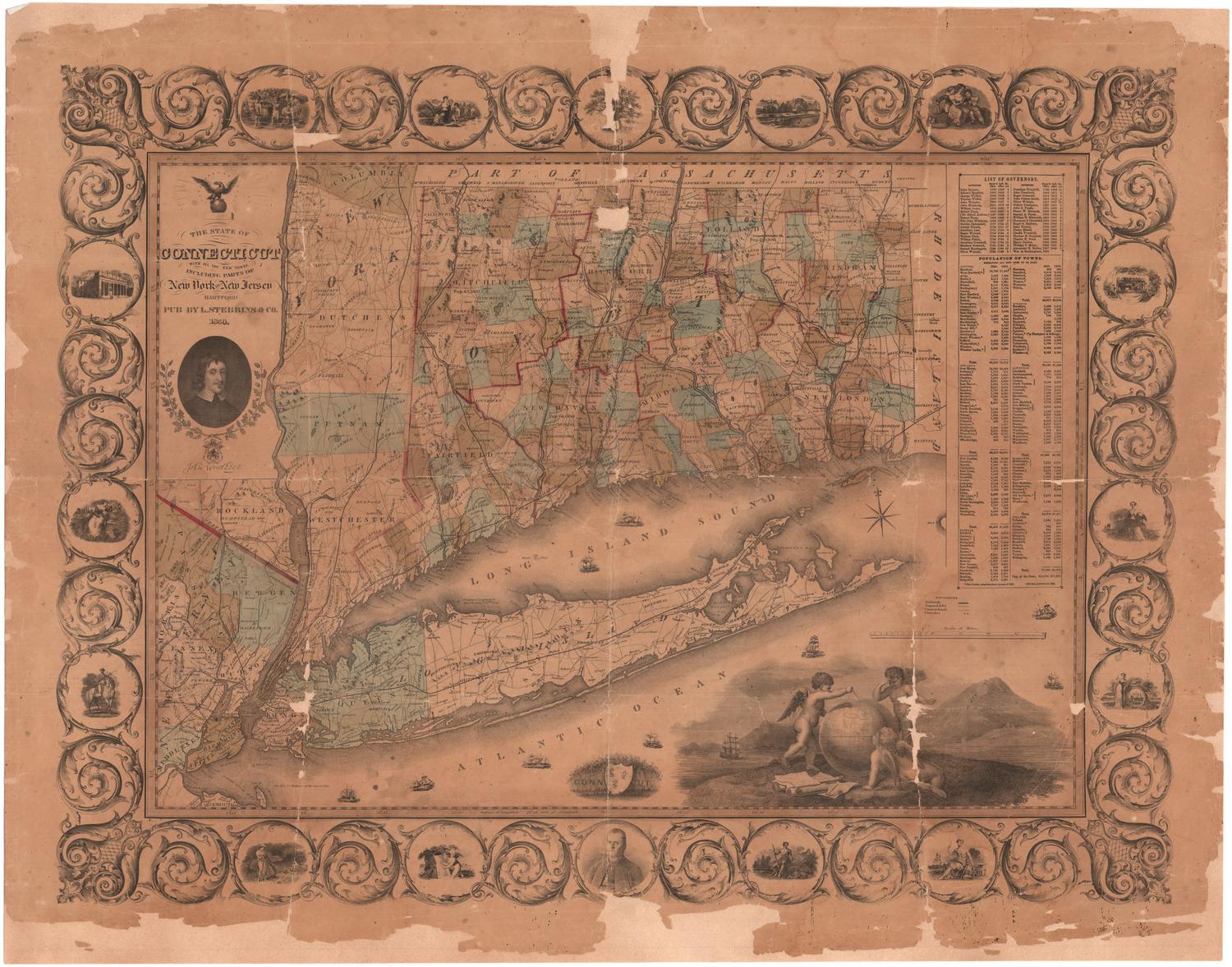
Lucius Stebbins & Co.
1859
Object/Object