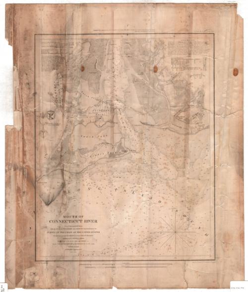
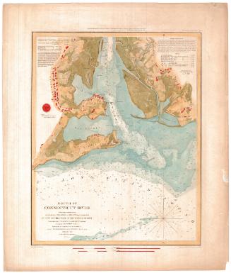
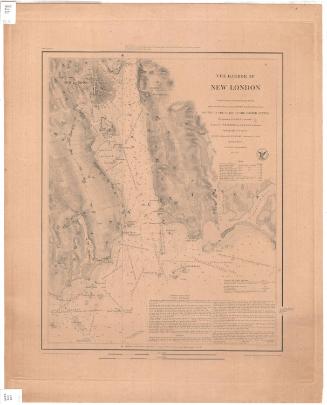
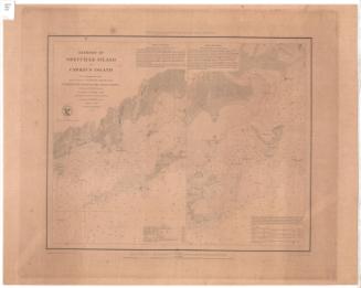
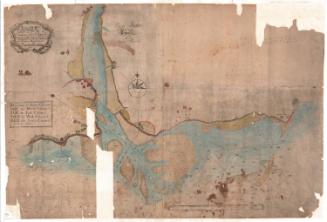
Mouth of Connecticut River
PublisherPublished by
United States Coast Survey
(American, founded 1807)
SurveyorSurveyed under the direction of
Ferdinand Rudolph Hassler
(American, 1770 - 1843)
SurveyorSurveyed under the direction of
Alexander Dallas Bache
(American, 1806 - 1867)
SurveyorTriangulation by
William Henry Smith
(1800 - 1879)
SurveyorTriangulation by
Edmund Blunt
(American, 1799 - 1866)
SurveyorTopography by
Henry L. Whiting
(American, 1821 - 1897)
SurveyorHydrography by
John R. Goldsborough
(American, 1809 - 1877)
SurveyorHydrography by
Maxwell Woodhull
(American, 1813 - 1863)
Date1853
MediumEngraving; black printer's ink on wove paper
DimensionsPrimary Dimensions (image height x width): 17 3/8 x 13 7/8in. (44.1 x 35.2cm)
Platemark (height only): 21in. (53.3cm)
Sheet (height x width): 21 3/4 x 18 3/8in. (55.2 x 46.7cm)
Platemark (height only): 21in. (53.3cm)
Sheet (height x width): 21 3/4 x 18 3/8in. (55.2 x 46.7cm)
ClassificationsGraphics
Credit LineConnecticut Museum of Culture and History collection
DescriptionMap of the mouth of the Connecticut River at Saybrook Point and Blackhall Point, with the River to the north, Blackhall Point to the east, the Long Island Sound to the south, and Saybrook to the west. The map depicts water depth and the location of reefs, rocks, buoys, lighthouses and hard and soft sand. Land features include elevation, conveyed through hachure marks, Fairfield Creek, fields, and stands of trees. Buildings are denoted with black shaded squares. There is a 32-point compass rose with an arrow marking the difference between true north and magnetic north. In the top left corner there is information about the soundings taken to confirm water depth and the tides. Sailing directions are written out in the top right corner.
Object number2012.312.194
NotesCartographic Note: Scale: 1:20,000; Nautical scale: About 3 1/2 inches equals 1 nautical mileOn View
Not on view

Object/Object