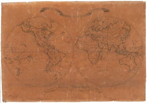
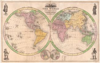
Map of the World According to the Latest Authorities
DraftsmanDrawn by
Julia Whitman
(American, 1804 - 1864)
Date1819
MediumDrawing; black ink on paper, lined with linen
DimensionsPrimary Dimensions (image height x width): 20 3/4 x 29 1/4in. (52.7 x 74.3cm)
Sheet (height x width): 20 3/4 x 29 1/4in. (52.7 x 74.3cm)
Sheet (height x width): 20 3/4 x 29 1/4in. (52.7 x 74.3cm)
ClassificationsGraphics
Credit LineConnecticut Museum of Culture and History collection
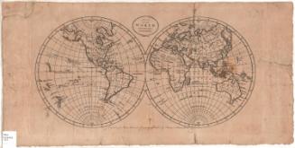
DescriptionManuscript map of the world, with the western hemisphere on the left side of the map and the eastern hemisphere on the right, both of which are inscribed with lines of latitude and a single line of longitude bisecting each hemisphere. The Equator, Arctic and Antarctic Circles, and the Tropics of Cancer and Capricorn are labeled. Geographic features include mountain ranges, denoted with hachure marks, deserts, rivers, seas and lakes, many of which are labeled. All of the land features are outlined with shading, including islands. The names of settlements are provided, as well.
Object number2012.312.193
NotesCartographic Note: No scaleOn View
Not on view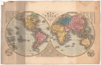

H. F. Sumner & Co.
1833