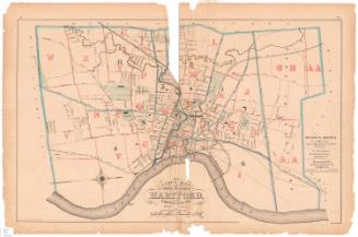
Map of Hartford
PrinterPrinted by
Hamersley & Co.
(American, 1868 - 1877)
Dateafter 1871
MediumLithography; black printer's ink and watercolor on wove paper
DimensionsPrimary Dimensions (image height x width): 31 x 18in. (78.7 x 45.7cm)
Sheet (height x width): 35 1/4 x 24 1/2in. (89.5 x 62.2cm)
Sheet (height x width): 35 1/4 x 24 1/2in. (89.5 x 62.2cm)
ClassificationsGraphics
Credit LineConnecticut Museum of Culture and History collection
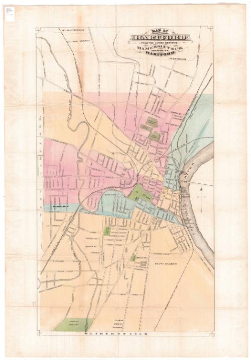
DescriptionStreet map of Hartford, Connecticut, from the town lines of Bloomfield and Windsor to the north, the Connecticut River to the east, the town line of Wethersfield to the south, and the town line of West Hartford to the west. Different sections of the city, probably wards, have been colored pale yellow, pink or blue. Green represents cemeteries and parks. The Connecticut Valley; New York, New Haven and Hartford; and Hartford, Providence and Fishkill Railroads run through the city.
Object number2012.312.189
NotesCartographic Note: No scale
Date Note: The map includes a depiction of the Connecticut State Capitol that does not correspond to the building as constructed. This suggests that the map predates the completion of the building and probably dates from the period of the design competition, 1871-1872.On View
Not on view