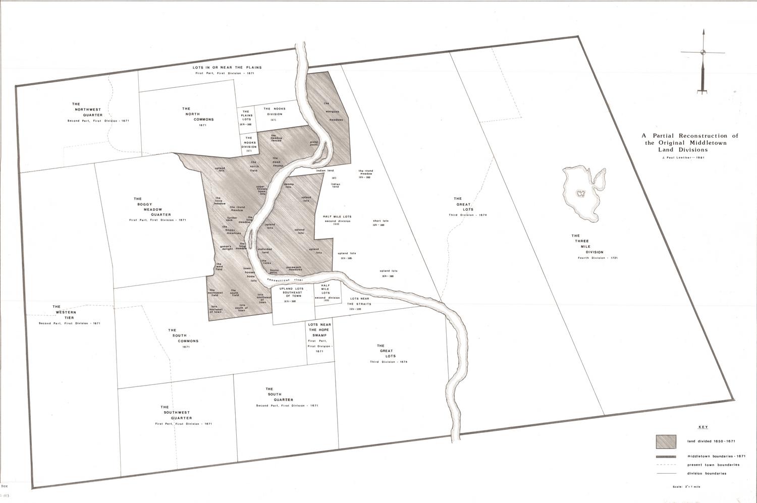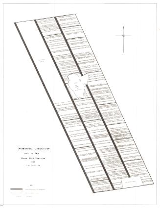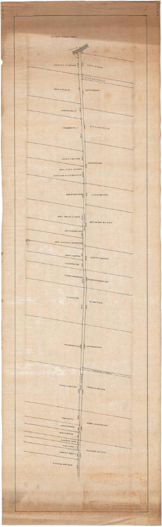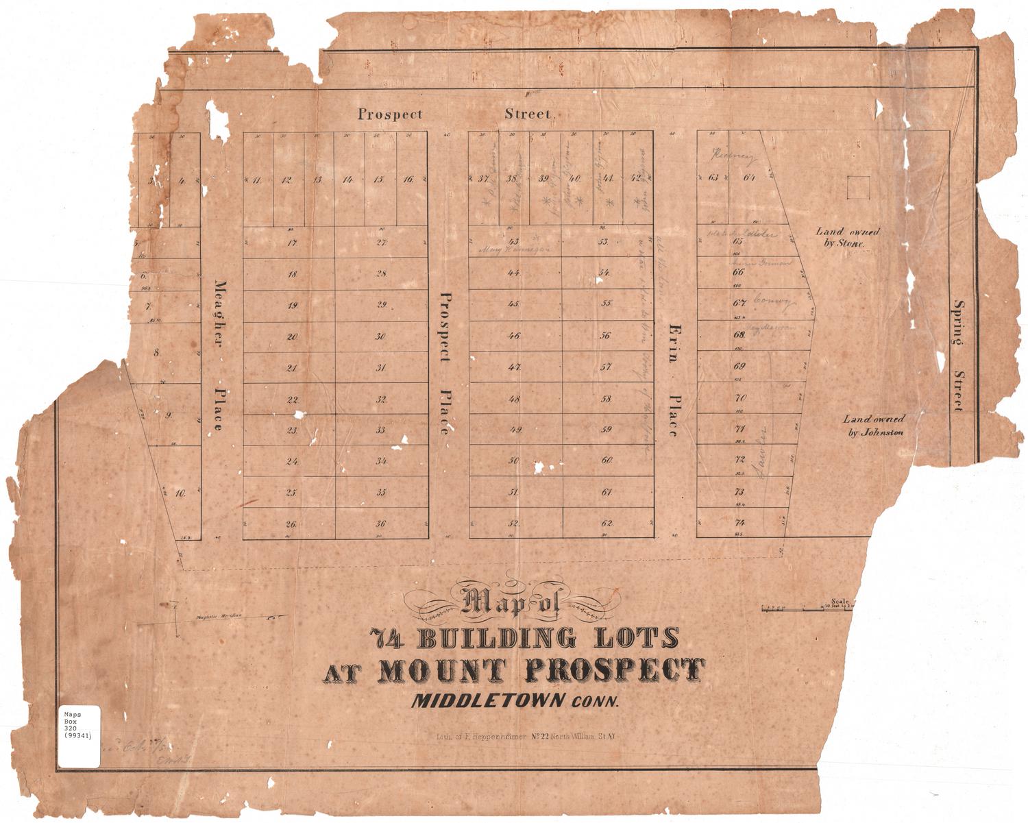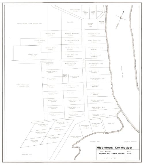
Middletown, Connecticut. Lower Houses: Homelots and Farmlots, 1650-1664
DraftsmanDrawn by
J. Paul Loether
(American, born 1953)
Date1981
MediumDrawing; pencil and dry transfer on paper
DimensionsPrimary Dimensions (image height x width): 22 1/4 x 19 1/2in. (56.5 x 49.5cm)
Sheet (height x width): 25 1/2 x 22 3/8in. (64.8 x 56.8cm)
Sheet (height x width): 25 1/2 x 22 3/8in. (64.8 x 56.8cm)
ClassificationsGraphics
Credit LineGift of J. Paul Loether
DescriptionMap of part of Middletown, Connecticut, extending from the Meeting House yard and burying ground to the north, the Connecticut River to the east, Pameacha Meadows to the south, and undivided land to the west. It depicts the farm and house lots along Main Street and Washington Street, as well as two unnamed local streets. Property owners are identified by name and the date of ownership, if available.
Object number1986.299.1
NotesCartographic Note: Scale: 1 inch equals 350 feetOn View
Not on view