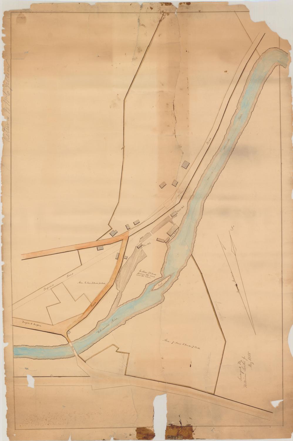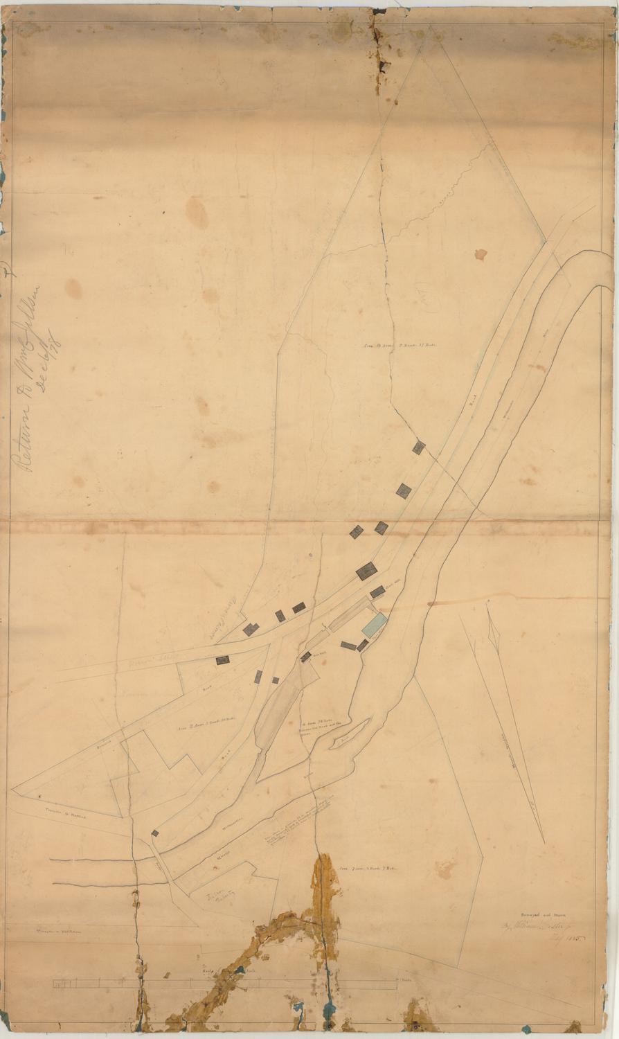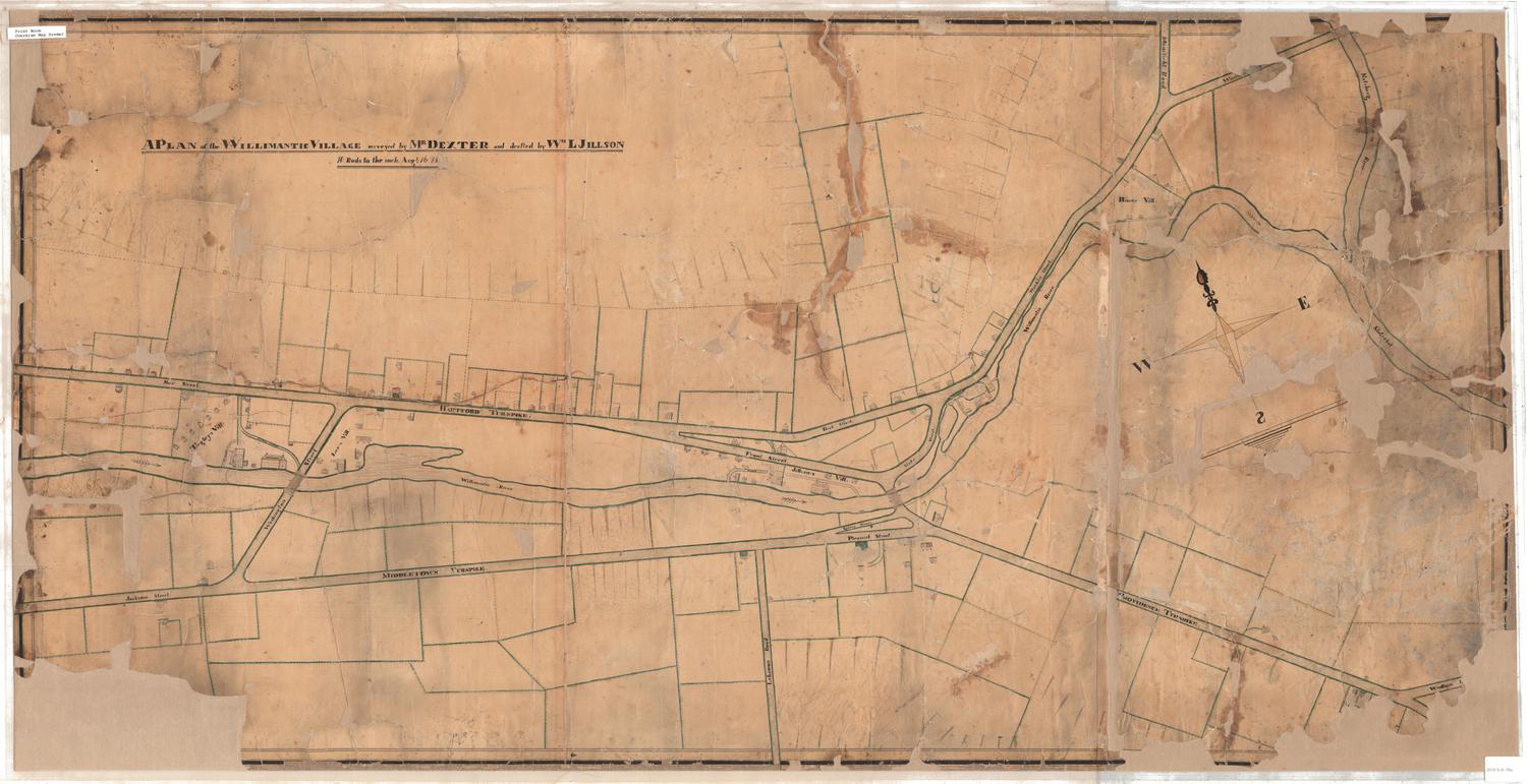
A Plan of the Willimantic Village
SurveyorSurveyed by
Mr. Dexter
(American)
DraftsmanDrawn by
Colonel William Lawrence Jillson
(American, 1807 - 1861)
Date1825-1845
MediumDrawing; ink and watercolor on paper
DimensionsPrimary Dimensions (image height x width): 29 3/8 x 58 5/16in. (74.6 x 148.1cm)
Sheet (height x width): 29 5/8 x 59in. (75.2 x 149.9cm)
ClassificationsGraphics
Credit LineConnecticut Museum of Culture and History collection
Object number2012.312.186
DescriptionManuscript map of Willimantic, Connecticut, consisting of three sheets. It extends from Main Street/the Hartford Turnpike to the north, the Natchaug and Shetucket Rivers to the east, Middletown Turnpike to the south, and Tingley's Village to the west. Plots of land, houses, mills and other buildings have been drawn in on Main Street and the Hartford Turnpike and the streets that branch off from them. Tingley's, Lee's, Jillson's and Hawe's Villages are labeled, and there is a four-pointed compass rose and north arrow on the right side of the map, with a backwards S. The Willimantic River runs through the village to where it meets the Natchaug and Shetucket Rivers. Along the banks of the Willimantic, and on what appear to be the outskirts of the village to the north and along Lebanon Road, there are stands of large trees to denote forest.
Label TextThe Lees, Tingleys, and Jillsons were all associated with the early development of the textile industry in Willimantic, Connecticut. Lee built his cotton mill in 1822; the Jillsons' first small mill was erected a few years later near the site of the present-day "Frog Bridge." In 1845, William L. Jillson, the son of Asa Jillson, formed a partnership with Austin Dunham and J. H. Capen to build a three-story mill and mill housing. Those buildings do not appear on this map, which William L. Jillson drew based on a survey by "Mr. Dexter." It therefore seems likely that the map predates this partnership and shows how Willimantic looked during its very early years. Austin Dunham and William L. Jillson went on to establish the Williamantic Linen Company in the 1850s, and began erecting huge stone mills, demolishing some of the small early mills in the process.
NotesCartographic Note: Scale: 1 inch equals 10 rodsDate Note: The date is partially obscured on the map; only the "18" is legible. The date on the map is partially illegible; only the "18" is visible. The year the Tingley tenements were constructed and William Jillson's date of death provide a narrower range than just the entire nineteenth century, but an exact date is unknown.
Subject Note: It is possible that the "Mr. Dexter" who appears in the note, could be Amariah W. Dexter (1809-1869), a Willimantic stone mason.
Status
Not on view