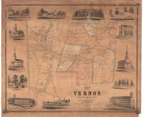
Map of the Town of Vernon, Tolland County, Conn.
SurveyorSurveyed by
E. M. Woodford
(American, 1824 - 1862)
PublisherPublished by
Richard Clark
(American)
PrinterLithographed by
Wagner & McGuigan
(American, 1845 - 1859)
Date1853
MediumLithography; black printer's ink and watercolor on paper
DimensionsPrimary Dimensions (image height x width): 33 1/4 x 40 5/8in. (84.5 x 103.2cm)
Sheet (height x width): 37 5/8 x 43in. (95.6 x 109.2cm)
ClassificationsGraphics
Credit LineConnecticut Museum of Culture and History collection
Object number2012.312.182
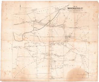
DescriptionPhysical and political map of Vernon, Connecticut, extending from Ellington to the north, Tolland to the east, Bolton to the south, and South Windsor to the west. Vernon is divided on the map into districts, all of which are labeled and outlined in a dotted line and pink or blue, except for the center district, which has no color. The Hartford, Providence and Fishkill Railroad runs through the town. Buildings and their owners are labeled, and elevation is denote with hachure marks. Bodies of water are blue.
To the left of the map of the town, there is a map of the village of Vernon, which extends from D. Hale's estate to the north, the Hockanum River to the east, S. Tracy's land to the south, and the border of the town of Ellington to the west. Roads, colored peach, are not labeled. Bodies of water appear in blue and are also unlabeled. Buildings are labeled with the names of their owners.
Around the map, clockwise from the top left, are thirteen vignettes: the residence of N. Kingsbury in Rockville; C. Hibbard's store and residence in Rockville; the residence of John W. Thayer in Rockville; the residence of A.C. Crosby in Rockville, the residence of Phineas Talcott, Esq., in Rockville; the Rockville Hotel; the 2nd Congregational Church in Rockville; the residence of N.O. Kellogg in Vernon; Rock Manufacturing Company's Mills in Rockville; N.O. Kellogg's woolen mill in Vernon; the American Mills in Rockville; the residence of George Kellogg in Rockville; the Congregational Church in Vernon; and the 1st Congregational Church in Rockville.
Label TextEdgar M. Woodford of Avon, Connecticut produced several important town and county maps during the 1850s. All of his maps, like this one of Vernon, Connecticut, were printed and published in Philadelphia, a major center of the lithography trade in the mid-nineteenth century. Woodford's map of Vernon shows early industrial development in Rockville, a village within the town of Vernon that would eventually (in 1889) be incorporated as a city. Vernon, the original town, remained a sleepy rural community throughout the nineteenth century, while Rockville developed into a major center of the textile industry. The textile industry in Rockville continued to expand at a rapid rate in the decades following the production of this map, as new mills were erected and new housing was built to house increasing numbers of workers.
NotesCartographic Note: Scale: 1 inch equals 80 rodsStatus
Not on view


The Connecticut Company