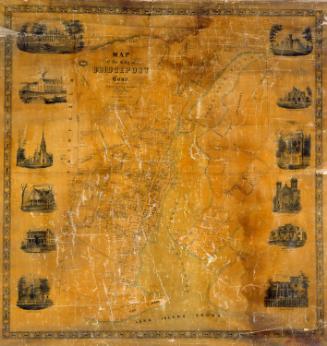
Clark's map of Fairfield County, Connecticut
SurveyorSurveyed by
Jacob Chace, Jr.
(American, 1819 - 1903)
PrintmakerLithographed by
Wagner & McGuigan
(American, 1845 - 1859)
PublisherPublished by
Richard Clark
(American)
Date1856
MediumLithography; black printer's ink and water color on paper
DimensionsPrimary Dimensions (image height x width): 60 3/8 x 51 7/8in. (153.4 x 131.8cm)
Sheet (height x width): 63 1/2 x 54 1/4in. (161.3 x 137.8cm)
Sheet (height x width): 63 1/2 x 54 1/4in. (161.3 x 137.8cm)
ClassificationsGraphics
Credit LineConnecticut Museum of Culture and History collection
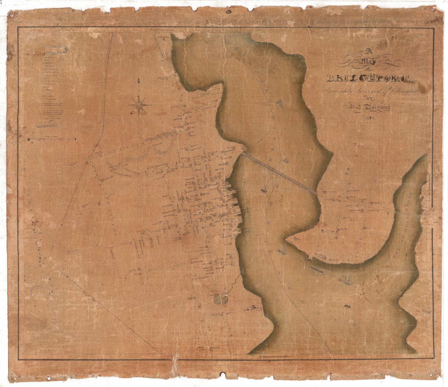
DescriptionPhysical and political map of Fairfield County, Connecticut, extending from Litchfield and New Haven Counties to the north, New Haven County to the east, the Long Island Sound to the south, and the state of New York to the west. Most of the town borders are outlined in red, green or pink and shaded in lighter tones of the same color, while some were left uncolored.
In addition to the map of the entire county, many towns, villages and boroughs have been detailed in plans inset around the county map: Georgetown, South Norwalk, Fairfield, Stamford, Newtown, Westport, New Canaan, New Fairfield, Brookfield, Norwalk, Brookfield Iron Works, Sherman, Sandy Hook, Southport, Greenwich, Black Rock, Mianus, East Porchester, Cos Cob, Bridgeport, Bethel, Danbury and Stratford. On the right and left sides, interspersed with the leafy border pattern, are vignettes of Iranistan, P.T. Barnum's residence; St. Pauls' Church in Fairfield; the residence of John B. Knapp in Stamford; the residence of F.M. Ray in South Norwalk; the residence of G. Keeler in Golden Hill; the residence of Captain W.L. Lyon in Greenwich; the residence of Richard W. Winslow in Westport; the Episcopal Church and Parsonage in Norwalk; the residence of A.S. Hammersley, Esq., in Westport; the residence of Z. Fairman in Newtown; the Golden Hill Institute and the Court House in Bridgeport.
At the bottom of the map, there are two tables, one that lists abbreviations for Fairfield County and one that lists the population of 22 towns according to the 1850 census.
Object number2012.312.179
NotesCartographic Note: Scale: 1 inch equals 250 rodsOn View
Not on view