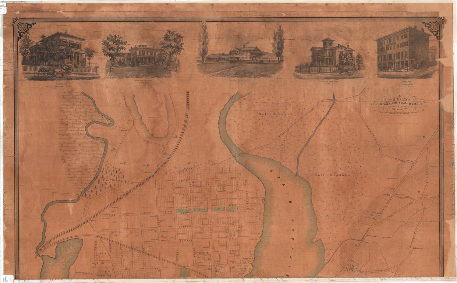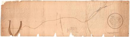

Plan of a proposed Turnpike road leading from New Haven City to Chapman's Ferry at Connecticut River
SurveyorSurveyed by
Unknown
SurveyorLocated by
Moses Warren Jr.
(1762 - 1835)
Date1817
MediumDrawings; black ink and watercolor on paper
DimensionsPrimary Dimensions (bottom, part a, image height x width): 48 1/2 x 13 1/2in. (123.2 x 34.3cm)
Sheet (bottom, part a, height x width): 48 1/2 x 13 1/2in. (123.2 x 34.3cm)
Primary Dimensions (top, part b, image height x width): 64 7/8 x 10 3/8in. (164.8 x 26.4cm)
Sheet (top, part b, height x width): 64 7/8 x 10 3/8in. (164.8 x 26.4cm)
Sheet (bottom, part a, height x width): 48 1/2 x 13 1/2in. (123.2 x 34.3cm)
Primary Dimensions (top, part b, image height x width): 64 7/8 x 10 3/8in. (164.8 x 26.4cm)
Sheet (top, part b, height x width): 64 7/8 x 10 3/8in. (164.8 x 26.4cm)
ClassificationsGraphics
Credit LineConnecticut Museum of Culture and History collection
DescriptionMap in two pieces showing a proposed turnpike road as it was suggested to run from Olive Street in New Haven, Connecticut, to a spot near the Connecticut River. The Mill and Dragon Rivers are shown near New Haven. The Hammonasset and Farm Rivers are also depicted. Along the road, some residences are depicted with small drawings of the buildings, with the owner's name next to it. One church is shown but not labeled. Turkey Hill and the "Pinnacle of Haddam" are labeled and located close to the Connecticut River. Town lines are included but the names of the towns are not. Another turnpike road is shown crossing the one surveyed. At the bottom of part a is the Explanation.
Object number2012.312.176a,b
NotesCartographic Note: Scale: 1/2 inch equals 10 chains
Constituent Note: "Messr. Warren," whose name appears on the map, was Moses Warren, of Lyme, Connecticut, the surveyor of New London County, and the man who collaborated with George Gillet on an important early map of the state of Connecticut. Warren apparently supported the plan for the Dragon Turnpike despite the fact that it would by-pass Lyme completely, crossing the Connecticut River farther north. The identity of Rossiter and Griswold, the other two men who "located" the turnpike, has not been established, nor has the surveyor who apparently drew this map, J. Sidney or Lindsay, been identified.On View
Not on view