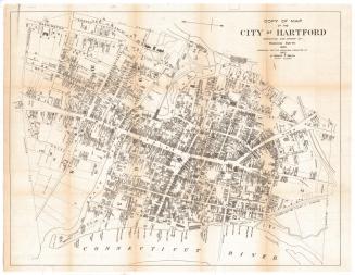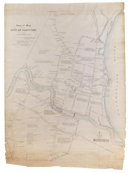
Copy of Map of the City of Hartford made by Solomon Porter in 1790
DraftsmanDrawn by
Theodore G. Ellis
(American, 1829 - 1883)
DraftsmanDrawn by
Luther W. Burt
(American, 1848 - 1921)
After a work byAfter a work by
Solomon Porter
(American, 1758 - 1821)
Date1894
MediumDrawing; pencil, black ink and watercolor on fabric
DimensionsPrimary Dimensions (image height x width): 52 3/4 x 42 1/2in. (134 x 108cm)
Sheet (height x width): 57 3/4 x 43in. (146.7 x 109.2cm)
ClassificationsGraphics
Credit LineConnecticut Museum of Culture and History collection
Object number2012.312.174
DescriptionManuscript map of Hartford, Connecticut, extending from the "North Line of the City" to the north, to the Connecticut River to the east, to the south green to the south, and the Little or Mill River to the west. Local businesses, residences and public spaces are included on the map, along with information about encroachments. Many of the streets have on them broken or dotted lines of measurement in degrees. A four-point compass rose and scale are in the lower right corner of the map.
Label TextSolomon Porter drew the first city map of Hartford in 1790. This important map was often referred to by later historians and mapmakers seeking to document the growth of the city, but it remained unpublished until civil engineer and surveyor Theodore Ellis produced an engraving based on Porter's original manuscript map in 1855. Almost forty years later, another Hartford surveyor, Luther Burt, made a copy of Ellis's version of Porter's map.
NotesCartographic Note: 1 inch equals two chains. A chain is 66 feet.Status
Not on view
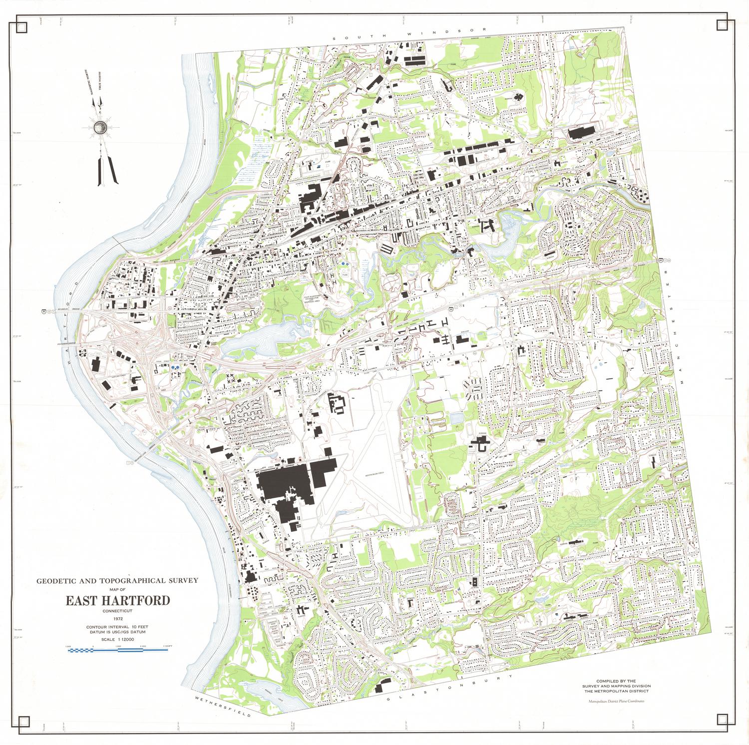
Metropolitan District Commission
1972