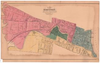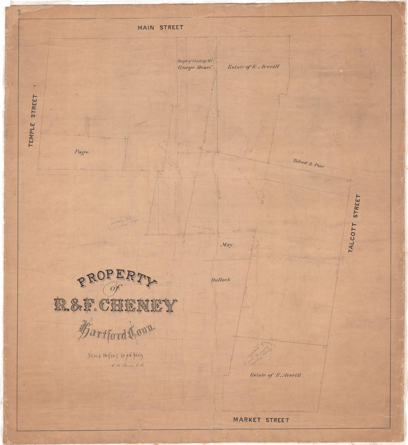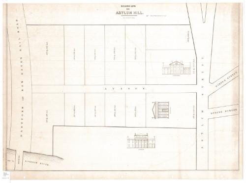
Building lots on Asylum Hill
PrinterPrinted by
E.B. & E.C. Kellogg
(American, 1840 - 1867)
Datebefore 1867
MediumLithography; black printer's ink on wove paper
DimensionsPrimary Dimensions (image height x width): 20 5/8 x 28 3/8in. (52.4 x 72.1cm)
Sheet (height x width): 21 5/8 x 29 1/4in. (54.9 x 74.3cm)
ClassificationsGraphics
Credit LineConnecticut Museum of Culture and History collection
Object number2012.312.171
DescriptionMap of part of Asylum Hill in Hartford, Connecticut, depicting what was probably Hopkins Avenue and the lots and houses on it. It is bounded to the east by Asylum Street (now Asylum Avenue), beyond which are Garden and Spring Streets, to the southwest by the "Sickenam" River (the Park River), and to the west by the Hartford and New Haven Railroad. There are 11 unnamed plots of land with dimensions, and three that have sketches of houses on them: two that have owners (O.E. Williams and J. Catlin) and one that is labeled, "Fancy Residence."
Label TextThe immediate vicinity of a railroad might seem an unlikely location for "fancy residences," like those shown on this map, but in the early years of the railroads, it was not unusual to find fine homes with lawns and gardens running right down to the tracks. The Julius Catlin House, formerly the home of poetess Lydia Sigourney, appears in early prints overlooking the railroad; residents apparently were not troubled by the noise of the trains entering and leaving the station, which was located nearby. The real estate developer who commissioned this map evidently hoped that other wealthy Hartford citizens would build on the adjoining lots, some of which were available for sale. The Sickenam River is an unusual name for the Park River; it appears in a description of the city published in 1851, and this map may have been made at about that date. This copy of the map may have belonged to O. E. Williams, whose house appears on the map and whose name is handwritten on the back of the map.
NotesCartographic Note: No scaleStatus
Not on view