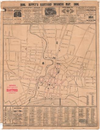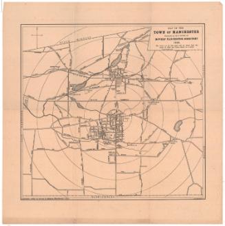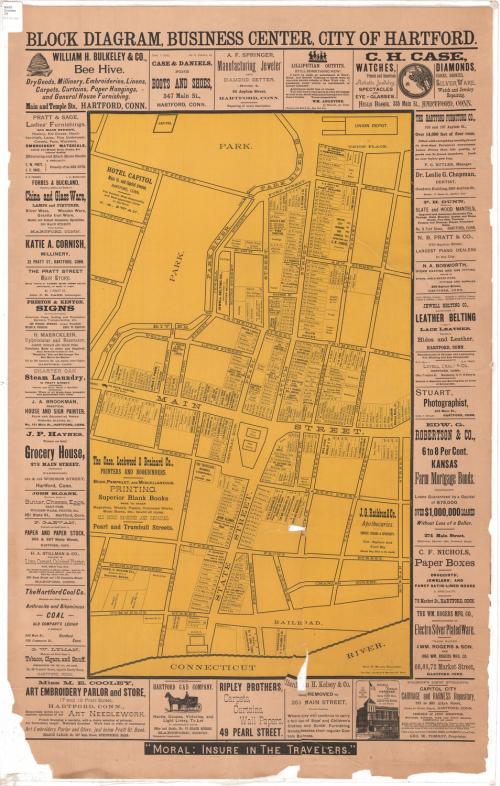
Block Diagram, Business Diagram, City of Hartford
DraftsmanDrawn by
Harry R. Williams
(American, 1861 - 1956)
PrinterPrinted by
Case, Lockwood and Brainard Company
(American)
Dateabout 1896
MediumLithograph; black and yellow printer's inks on wove paper
DimensionsPrimary Dimensions (image height x width): 28 1/4 x 16 1/4in. (71.8 x 41.3cm)
Sheet (height x width): 38 3/8 x 24in. (97.5 x 61cm)
Sheet (height x width): 38 3/8 x 24in. (97.5 x 61cm)
ClassificationsGraphics
Credit LineConnecticut Museum of Culture and History collection
DescriptionStreet map of downtown Hartford, Connecticut, from Union Depot to the north, Church and Morgan Streets to the east, the Connecticut River to the south, and the Park River to the west. The map shows lots containing street numbers and the names of businesses and/or business owners. Several advertisements appear on the map itself: Hotel Capitol, The Case, Lockwood & Brainard Company, and J.G. Rathbun & Company. Around the map on all sides are advertisements for the businesses, some consisting only of the name and address and a brief description, and some with a pictorial depiction of some aspect of the business.
Object number2012.312.165
NotesCartographic Note: No scale
The map contains no dates, or publisher but, note that one business, 'Capitol City Carriage and Harness Repository' opened in 1985. Therefore the map was made then or soon after.On View
Not on view