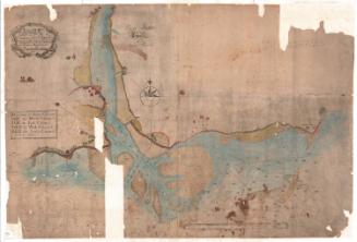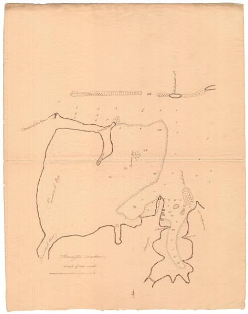
Stonington Harbor
SurveyorSurveyed by
Unknown
Datebefore 1824
MediumDrawing; ink on paper
DimensionsPrimary Dimensions (image height x width): 17 x 14 1/2in. (43.2 x 36.8cm)
Sheet (height x width): 22 x 17 3/8in. (55.9 x 44.1cm)
Sheet (height x width): 22 x 17 3/8in. (55.9 x 44.1cm)
ClassificationsGraphics
Credit LineMuseum purchase
DescriptionManuscript map of Stonington Harbor, Connecticut, from Stonington to the north, Pawcatuck Bay to the east, Wickapuset Island to the south, and Wamphassoc Point to the west. The mouth of the Pawcatuck River is in the top right corner. Water depth is given (presumably in meters), and the locations of shoals and reefs are marked with Xs and labeled. The title appears upside down when viewing the map with the north arrow, located at the top, pointing up.
Object number1975.102.2
NotesCartographic Note: Scale: Almost 3 1/4 inches equals 1 mileOn View
Not on view